Use this free online tool to calculate lot size for an ancestor’s piece of property. The drawing tools overlaid on Google Maps help you determine the area of a lot and distances along its perimeter.
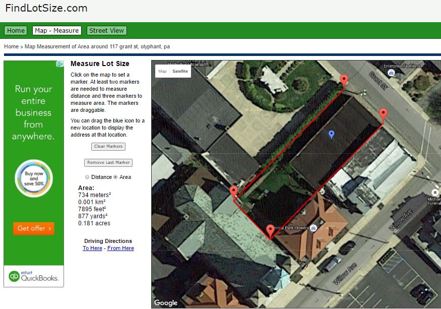
Researching a family piece of property can be tricky for several reasons. But there’s an easy and free tool you can use to help you calculate the size of an ancestor’s lot. It’s FindLotSize.com. This is what it looks like to use:

Here’s how to use it to calculate lot size:
1. Go to FindLotSize.com.
2. Enter a street address and click Go. (If you don’t know an exact street address, get as close as you can, then zoom around on the screen until you can see the property of interest.)
3. Zoom in (or out) to the level that you can see all the lot boundaries.
4. Click on one corner of the lot. A red marker will appear. Then click on the other corners in sequence to draw the perimeter. You don’t need to “close the gap” by clicking a second time on the starting point; the site will automatically assume you mean for the last point you enter to connect to the first. The site will calculate the lot size in square meters/kilometers, square feet/yards and acres.
Here are a couple more tips for using the site:
 If you wish to know the distance around the perimeter, click Distance. (You can measure individual distances, such as the width of the lot at the back, by only clicking on the points between which you want to measure.)
- In the upper left are options to view satellite or map images. The satellite view is a bird’s eye view of the land today. You’ll see fence lines, roads, hedges and other practical clues to property boundaries. But sometimes these are obscured by tree cover. If you click on “map,” you’ll see a simple line rendering, like a traditional map, but with many buildings outlined. Depending on the tree cover, you may find this view helpful.
Google Earth + Old Map = Family History Discovery
4 Great Local History Apps for Genealogy
4 Steps for Using Google Earth for Genealogy


