by Lisa Cooke | Dec 6, 2013 | 01 What's New, British, Canadian, Records & databases
If you’ve got British colonial roots in North America, you know how tough it can be to learn more about your family during that time. That’s why I was excited to read a
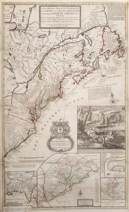
The Beaver Map, 1715. By Special Collections Toronto Public Library. Flickr, via Wikimedia Commons.
recent article in the Harvard Gazette.
According to the article, plans are afoot to digitize and make available millions of British colonial documents. Yep, you read that right. Millions. There are still that many colonial-era documents sitting largely untouched in public and private archives, far from the reach of the everyday genealogist.
The Gazette reports not one but two major digitizing projects underway relating to British colonial documents in the U.S. Harvard University is leading the first project, which is already funded and underway. It will capture around 30 million pages of 17th- and 18th-century material from more than 1600 manuscript collections at 12 different Harvard repositories.
As if that’s not good enough news, a much larger project is in the works, too. A larger-scale Colonial Archives of North America has plans to digitally assemble pre-Revolutionary War material from Harvard and several historical societies, archives and Libraries in New England, New York and beyond (including Montreal). I was pleased to see that records relating to businesses, poverty, public health and indigent care will form part of the anticipated collection. These kinds of documents talk about everyday folks and their living conditions. Just what we want for our colonial genealogy. This second project is not funded yet but researchers are confident it will be.
Meanwhile, check out online resources like these for colonial documents:
by Lisa Cooke | Nov 21, 2013 | 01 What's New, Book Club, Inspiration, Photographs, Research Skills, Technology
Ever wish there was a really easy directory for U.S. digital libraries and archives, organized by state with great commentary about the content? There  is. But it’s not in a place most genealogists would look.
Open Education Database.org has a blog post called “250+ Killer Digital Libraries and Archives.” The post is a LONG annotated list of digital libraries and archives that don’t require library memberships, subscriptions, etc. to access. (In other words, open access.) It’s organized by U.S. state, so you can scroll down to the states of most interest to your research.
Digital archives and libraries give us remote, fingertip access to original and published materials we might never otherwise know about or be able to access. Look here for books, government documents, photographs, manuscript items, memorabilia, audio recordings and more. This is a great resource for genealogists. Click the link above to get all the info.
by Lisa Cooke | May 8, 2013 | 01 What's New, Maps
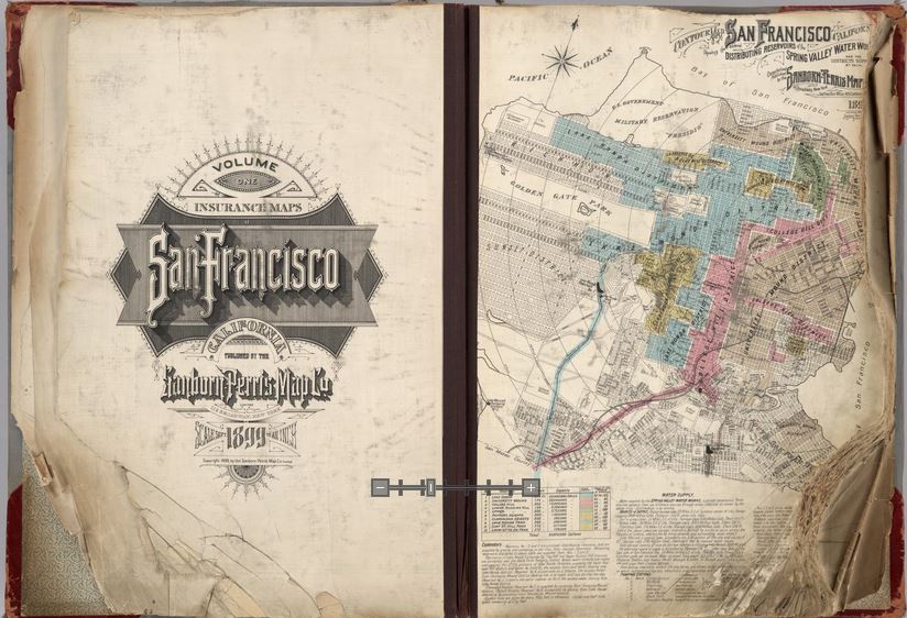
Opening pages of rare 1905 Sanborn Map of San Francisco, showing city just before 1906 earthquake. Find the entire map book at the David Rumsey Historical Map Collection
Genealogists rely on historical maps to help us navigate the geography of our ancestors’ lives. One of the most important resources available online is the David Rumsey Map Collection. Well, Rumsey recently announced on his website that he will be making more than 38,000 of his historical maps–everything he’s currently got online–available at the Digital Public Library of America (DPLA).
I blogged recently about the DPLA, which aims to create an enormous, free digital library we can all access online. It will be great to have the Rumsey map collection searchable on the DPLA so we can search these maps while we look for any other sources on any particular location our ancestors lived. “Maps tell stories that complement texts, images, and other resources found in the growing DPLA library,” says Rumsey. “And the open content policies of my online library fit perfectly with DPLA’s mission to make cultural resources freely available to all.” He applauds what the DPLA is trying to accomplish and even encourages other collectors to donate content.
Rumsey has spent years collecting thousands of old maps and putting them online. Now he’s working to share them even more widely. His entire collection of about 150,000 maps will eventually be housed at Stanford University. Meanwhile, we can all enjoy the thousands of images we can search on his site or at the DPLA.
Google’s free program Google Earth includes nearly 150 historic maps in the Layers panel. You can also add historic maps downloaded from Rumsey’s site to Google Earth by using the Overlay feature. My video tutorial series called Google Earth for Genealogy will show you how. You can also get step-by-step instructions in my book The Genealogist’s Google Toolbox. Or get them all in a discounted bundle.


