Looking for a pre-1700 map of the Americas as the Europeans found it? Yearning to survey the plot of land your ancestors tilled in Cobb County, Georgia? Historic maps can point you in the direction of your ancestors. But navigating your way to an original map can be a costly and time-consuming trek. Before you venture down that road, navigate your way to the treasury of digitized maps available online!
A new video class can help Genealogy Gems Premium members do just that: Best Websites for Finding Historical Maps. Literally hundreds of thousands of historical maps are available for free online in high-resolution digital format that you can download right to your computer without ever leaving home. The websites I show you offer some of the largest map collections available on the Internet today. I demonstrate strategies for searching the best websites for historical maps that will help YOUR research. You’ll see what’s out there, how to find the right maps and how to download and use them.
Imperial Airways Map of Empire & European Air by Laszlo Moholy-Nagy, 1937. Online at DavidRumseyHistoricalMaps.com. Click on the image to see full citation information.
Among more than 15,000 maps and images newly posted at the David Rumsey Map Collection, these caught my eye as particularly useful for family history. Do any of them look relevant to YOUR genealogy?
1. A massive group of German Invasion plans for England, Wales, and Ireland in WWII;
If your family lived in the U.S. between the late 1800s to mid-1900s, you should look for their home on Sanborn Fire Insurance Maps.
The Sanborn Map Company published maps from 1867 to 1970 to evaluate fire insurance liability in urban areas. The maps are detailed street plans on large sheets of paper—one sheet shows about four to six city blocks.
You can learn a lot about your ancestor’s house and neighborhood from these maps, or research the history of your own old house. These maps show building outlines, locations of windows and doors, building use (including the names of most public buildings), property boundaries, house and block number, street names and more.
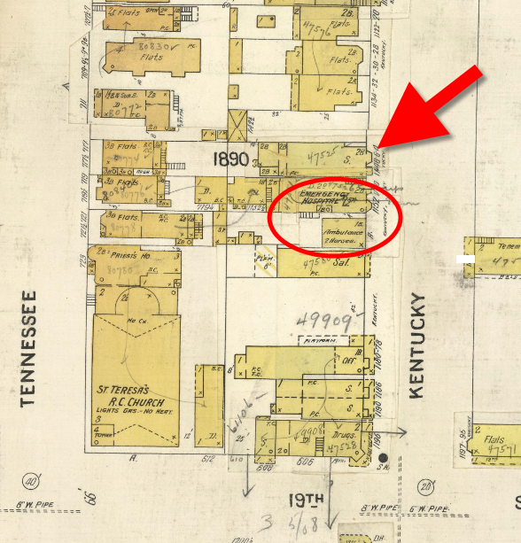
Here’s an example of how I’m using Sanborn Fire Insurance Maps for my family history. Below is the Sanborn Fire Insurance Map for San Francisco in 1905. My great grandparents house has long since been torn down, but I know that the original address back before the great earthquake of 1906 was 1144 Kentucky Street. The Sanborn Fire Map for this neighborhood sheds light on why they picked this location when they first married. Not only is it on Kentucky Street where my Great Grandfather Charles worked the Kentucky Streetcar line as a conductor, but it’s right next door to an Emergency Hospital complete with two ambulances and 2 horses. Why is this significant? Because Great Grandmother Ellen was a nurse when they met!
Learn how to use these under-valued genealogy resources and where to find them in my NEWPremium video on using Sanborn Fire Insurance Maps. In the video I demonstrate using the maps in Google Earth, which is something you may not find anywhere else! The companion handout for the class is a guide to finding Sanborn Fire Insurance Maps online.
Not a Premium member yet on our site? For one low price, you get a full year’s access to my full video archive with more than two dozen classes (click here for a current list) and about 100 Premium podcast episodes, with exclusive interviews and in-depth how-tos (click here for a current list). Click here to learn about additional membership benefits and how to join!
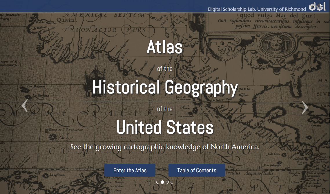
Atlas of the Historical Geography of the United States, http://dsl.richmond.edu/historicalatlas/.
Digital archives are getting so much better! They’re not just about reproducing historical documents anymore. Multimedia add-ons–from searchable statistics to animated timelines–fill in the gaps not explained by the map keys.
Recently, Slate.com writer Rebecca posted on some of her favorite digital archives. Four of the five are of interest to genealogists! Read the article to learn more about them:
Noisy New York City: An interactive database on noise complaints in the Big Apple during the 1920s and 1930s.
Jamaican Slave Revolt: See an interactive map and timeline of the complicated uprising of about 1500 enslaved workers in 1760-61 on the island.
Atlas of the Historical Geography of the United States: animated atlases that put historical data behind the maps. For example, you can see an animated representation of the growth of the Catholic church in the U.S., 1775-1890.
Do you ever get lost when looking for ancestral hometowns in Europe or other parts of the world? Boundaries change–national ones as well as regional ones. Place names change. Several little villages may all have gone by the same name over time. And darn those spelling and place name variants!
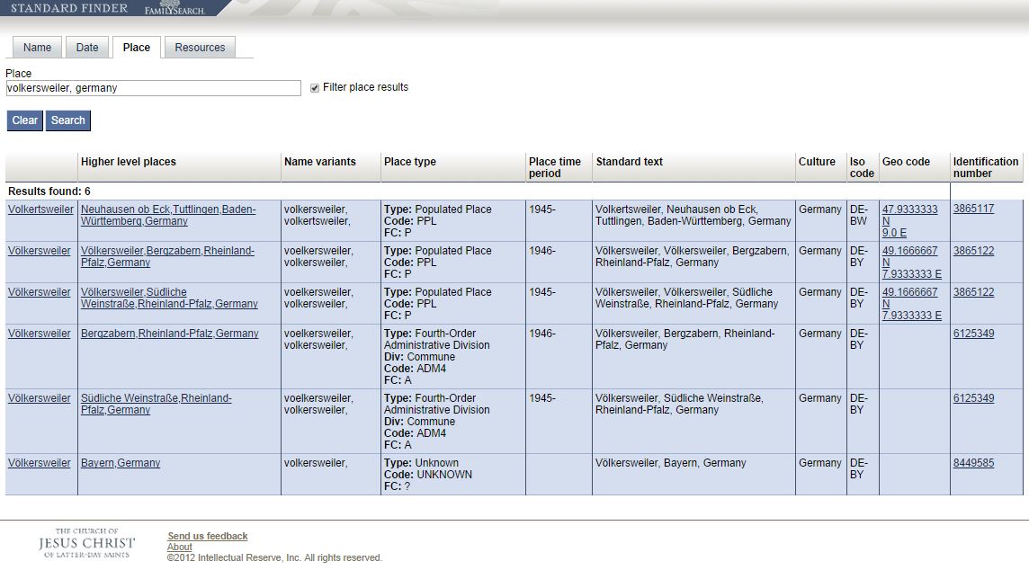
There’s a great online tool for finding places on a map. It’s the FamilySearch StandardFinder. Under the Place tab, enter the place name that’s got you befuddled. You’ll get a result screen that looks something like this:
What do each of those columns mean? We asked a Product Manager at FamilySearch and here’s what he told us:
Column 1: The official name of the place.
Column 2: Link/official name to the jurisdiction that the place exists within.
Column 3: “Normalized” variant names (i.e. other names the place is known by)
Column 4: General/high-level type (the type) of the place. Div: The more specific type (if applicable). Code: The code for the general type. FC: The feature code (taken from NGA’s feature code).
Column 5: The years within which the place existed (typically within the jurisdiction it belongs to).
Column 6: The full official (standardized) name of the place and its jurisdiction.
Column 7: Culture: The generalized culture that the place exists within.
Column 8: ISO code: The ISO code (if applicable).
Column 9: Geo code: the “centroid” (or central spot) of the place specified as the latitude and longitude.
Column 10: The permanent identifier of the place, useful for referencing the place within applications, systems, and products.”
A couple of these columns are a little technical for me, but I can still extract a LOT of information from these results! Place names, variant names, jurisdictions, lifespan of that location, latitude/longitude and all the possible places a possible location might be.
You’ll likely notice that there are Standard Finders for names and dates, too!
 Looking for a pre-1700 map of the Americas as the Europeans found it? Yearning to survey the plot of land your ancestors tilled in Cobb County, Georgia? Historic maps can point you in the direction of your ancestors. But navigating your way to an original map can be a costly and time-consuming trek. Before you venture down that road, navigate your way to the treasury of digitized maps available online!
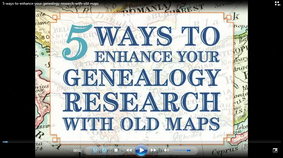
 Genealogy Gems Premium members also have access to my popular online video class, 5 Ways to Enhance Your Genealogy Research with Old Maps. Not a Premium member? Get a taste of these classes for free on the Genealogy Gems YouTube channel! Check out this free excerpt: “Using Sanborn Fire Maps for Family History and Genealogy.”