by Sunny | May 4, 2018 | 01 What's New, British, Irish, Jewish, Maps, Native American, Records & databases
These free online historical maps may help you learn more about your ancestors’ daily lives and flesh out your family history. Find maps for Victorian and Edwardian England and Wales; indigenous people of Canada and the U.S.; European synagogues; the Soviet military during WWII and even shipwrecks in and around Ireland.
We’ve reported previously on fantastic interactive map tools to help you learn more about your ancestors’ worlds. The best interactive maps don’t just give you locations: they combine locales with statistics, historical timelines, images or stories to help you get a sense of that time and place. (One amazing site that comes to mind is Bomb Site, an interactive map of the London Blitz.)
Recently, several interactive map tools have come across my desk for consideration in our weekly Friday Records post, so here’s a nice roundup of them. Whether you have ancestors from these places or cultural communities, or whether you just love old maps as Lisa Louise Cooke and I do, we think you’ll enjoy these.
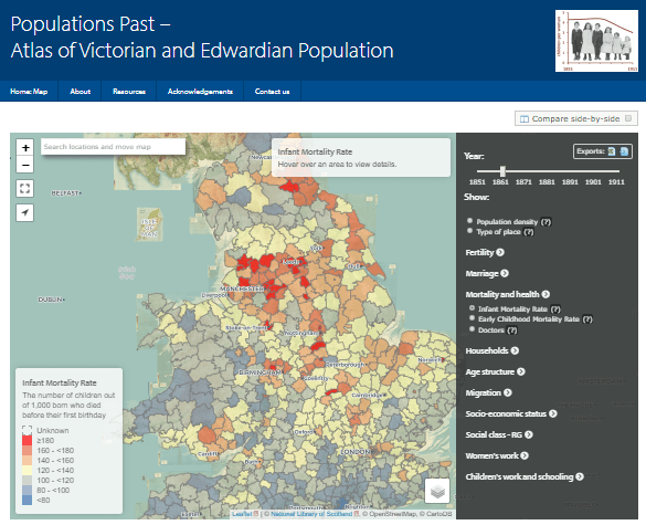
Featured Free Online Historical Map: Populations Past
Populations Past is a new interactive online atlas of Victorian and Edwardian populations in England and Wales. According to the site overview page, “The second half of the nineteenth century was a period of major change in the dynamics of the British population….[But] this transition was not uniform across England and Wales….This website allows users to create and view maps of different demographic measures and related socio-economic indicators every 10 years between 1851 and 1911. These include fertility, childhood mortality, marriage, migration status, household compositions, age-structure, occupational status and population density.” Brief explanations are included, and you can zoom in, compare maps and even download them. The atlas is hosted on the University of Cambridge website.
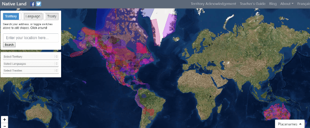
Map of Native Lands and People
Yes! Magazine has reported on the free Native Land website and app, which help you learn about the history of wherever you are (or wherever you want to learn about). According to the article, the site “seeks to map Indigenous languages, treaties, and territories across Turtle Island” (North America). As you can see from the screenshot below, though, other parts of the world are also included. When you enter any ZIP code, the map “will zoom in on your inquiry, color-code it, and pull up data on the area’s Indigenous history, original language, and tribal ties.”
The site’s About page stresses that the boundaries and names used are meant to come from the point of view of native people (rather than their conquerors) and that different perspectives exist. The site does actively solicit user feedback, though so much has been received that corrections are temporarily on hold. It’s certainly a fascinating lens through which to view the history of the land your ancestors lived on or settled—or perhaps even the property on which you yourself live now.
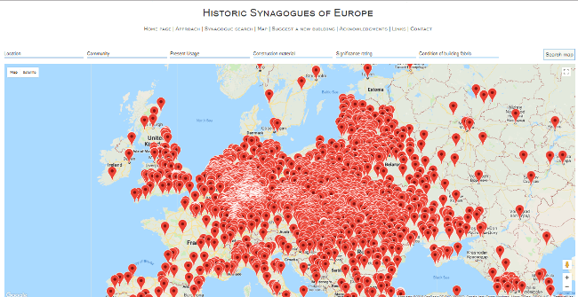
Map of European synagogues
Over 3000 synagogues have been mapped out at the free website, Historic Synagogues of Europe. The site aims “to provide a comprehensive and up-to-date inventory of the historic synagogues of Europe,” encompassing the 47 member states of the Council of Europe plus Belarus. Information about the various buildings, their historical and cultural significance, their current condition and their associated communities are included. Genealogists tracing Jewish ancestors might search extant synagogues located near an ancestor’s home, if known, to learn more about the building and at least to generally identify the communities that called it home. Sadly, though, according to this report on the site, only about 19% of European synagogues built before World War II are still standing.
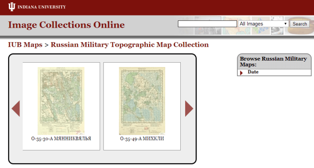
4,000 Russian maps being digitized
A collection of about 4,000 topographical maps at Indiana University have traveled a long way (physically and culturally) since being produced by the Soviet military between 1883 and 1947. According to a press release, these maps of “the Eastern Bloc Borderlands project portray Poland, Ukraine, Belarus, Latvia, Lithuania, Estonia, Finland, and Western Russia – all areas greatly impacted by World War II and of strategic importance to Russia and the Soviet Union.”
These regions have changed greatly since the maps were created. In many cases, the maps identify villages and boundaries that no longer exist. The collection is being digitized because it contains such unique information that is of value to the international community. (What value may it have for your family history??)
About 1,000 of these maps have already been digitized and can be viewed at Indiana University’s Image Collections Online. The rest are forthcoming.
Shipwrecks around Ireland
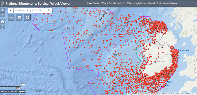
Do you have relatives who may have been shipwrecked off the coast of Ireland? A new interactive map, the National Monuments Service Wreck Viewer, charts nearly 4,000 shipwrecks around the island. The data comes from the Wreck Inventory of Ireland Database, which catalogs thousands more wrecks that don’t have precisely known locations. In addition to a location, some wrecks report the name of the ship, the date of the wreck, the type of boat or ship and source of data (from Lloyd’s to a group of amateur divers). Many wrecks show very scant information but you may be able to use it in combination with other family history discoveries, such as newspaper articles or emigrant passenger lists, to add depth to your family history stories.
by Lisa Cooke | Jul 21, 2017 | 01 What's New, British, Irish, Maps, Records & databases
Digitized Irish historical maps are among new genealogy records online. Also: Irish civil registrations; Irish, British, and Scottish newspapers; Westminster, England Roman Catholic records; wills and probates for Wiltshire, England and, for the U.S., WWI troop transport photos, Tampa (FL) photos, Mayflower descendants, NJ state census 1895, western NY vital records, a NC newspaper, Ohio obituaries, and a Mormon missionary database.
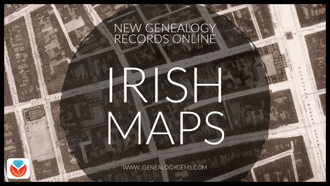
Beautiful Irish historical maps
 Findmypast.com has published two fantastic new Irish historical map collections:
- Dublin City Ordnance Survey Maps created in 1847, during the Great Famine. “This large-scale government map, broken up into numerous sheets, displays the locations of all the streets, buildings, gardens, lanes, barracks, hospitals, churches, and landmarks throughout the city,” states a collection description. “You can even see illustrations of the trees in St Steven’s Green.”
- Ireland, Maps and Surveys 1558-1610. These full-color, beautifully-illustrated maps date from the time of the English settlement of Ulster, Ireland. According to a collection description, the maps “were used to inform the settlers of the locations of rivers, bogs, fortifications, harbors, etc. In some illustrations, you will find drawings of wildlife and even sea monsters. Around the harbors, the cartographers took the time to draw meticulously detailed ships with cannons and sailors. Many of the maps also detailed the names of the numerous Gaelic clans and the lands they owned, for example, O’Hanlan in Armagh, O’Neill in Tyrone, O’Connor in Roscommon, etc.”
(Want to explore these maps? Click on the image above for the free 14-day trial membership from Findmypast.com!)
More Ireland genealogy records
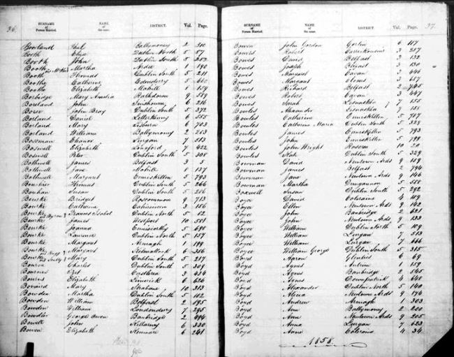
Sample page, Ireland marriage registrations. Image courtesy of FamilySearch.
FamilySearch.org now hosts a free online collection of Ireland Civil Registration records, with births (1864-1913), marriages (1845-1870), and deaths (1864-1870). Images come from original volumes held at the General Register Office. Click here to see a table of what locations and time periods are covered in this database. Note: You can also search free Irish civil registrations at IrishGenealogy.ie.
New at the British Newspaper Archive
The Irish Independent, a new national title for Ireland, is joined in the Archive this week by eight other brand new titles. These include four titles for Scottish counties: Aberdeenshire, Lanarkshire, Angus (Forfanshire) and Wigtownshire. There are also four new papers for England, two of which are from London (Fulham & Hampstead), one for Worcestershire and one for West Yorkshire. Also, significant additions have been made to the British Newspaper Archive’s online coverage for the Brechlin Advertiser (Scotland, added coverage for 1925-1957) and Southend Standard and Essex Weekly Advertiser (added coverage for 1889-1896).
Roman Catholic Records for Westminster, England
Over 121,000 new Roman Catholic parish records for the Diocese of Westminster, England are now available to search on Findmypast.com in their sacramental records collections:
- Parish baptisms. Over 94,000 records. The amount of information in indexed transcripts varies; images may provide additional information such as godparents’ names, officiant, parents’ residence, and sometimes later notes about the baptized person’s marriage.
- Parish marriages. Nearly 9,000 additional Westminster records have been added. Transcripts include couples’ names, marriage information, and father’s names. Original register images may have additional information, such as names of witnesses and degree of relation in cases of nearly-related couples.
- Parish burials. Transcripts include date and place of burial as well as birth year and death; images may have additional information, such as parents’ names and burial or plot details.
- Additional congregational records. More than 16,000 indexed records of confirmations, donations, and other parish records are included here.
London Marriage Licences 1521-1869
Findmypast has published a searchable PDF version of a published volume of thousands of London Marriage Licenses 1521-1869. Search by name, parish, or other keyword. A collection description says, “Records will typically reveal your ancestor’s occupation, marital status, father’s name, previous spouse’s name (if widowed) and corresponding details for their intended spouse.” Note: The full digital text of this book is free to search at Internet Archive.
Wills and Probate Index for Wiltshire, England
Explore more than 130,000 Wiltshire Wills and Probate records in the free Findmypast database, Wiltshire Wills and Probate Index 1530-1881. “Each record consists of a transcript that will reveal your ancestor’s occupation, if they left a will and when they left it,” says a description. “The original Wiltshire wills are held at the Wiltshire and Swindon Archive. The source link in the transcripts will bring you directly to their site where you can view their index and request an image. If you wish to view an image, you will have to contact Wiltshire Council and a small fee may be required for orders by post.”
New records across the United States
WWI: Ancestry.com subscribers may now access a new online collection of photographs of U.S., WWI Troop Transport Ships, 1918-1919. Browse to search by ship name.
Florida. The city of Tampa, Florida has digitized and published two historic photo collections on Hillsborough County Public Library Cooperative Digital Collections:
- The Greater Tampa Chamber of Commerce Collection includes over 30,000 images of Tampa events dating from about 1950 until 1990, and includes many local officials and dignitaries.
- The Tampa Photo Supply Collection includes more than 50,000 images of daily life and special events (weddings, graduations) taken by local commercial photographers between 1940 and 1990, primarily in West Tampa, Ybor City, and South Tampa.
Mayflower descendants. AmericanAncestors.org has published a new database of authenticated Mayflower Pilgrim genealogies: Mayflower Families Fifth Generation Descendants, 1700-1880. The collection includes the carefully-researched names of five generations of Mayflower pilgrim descendants.
New Jersey. The New Jersey State Census of 1895 is now free to search at FamilySearch.org, which also hosts an 1885 New Jersey state census collection. “The state of New Jersey took a state census every 10 years beginning in 1855 and continuing through 1915, says a FamilySearch wiki entry. “The 1885 census is the first to survive in its entirety.” Click here to learn more about state censuses in the United States.
New York. Ancestry.com has published a searchable version of a genealogy reference book, 10,000 Vital Records of Western New York, 1809-1850. According to a collection description, “The 10,000 vital records in this work were drawn from the marriage and death columns of five western New York newspapers published before 1850….Birth announcements were not published in these early newspapers, but many of the marriage and death notices mentioned birth years, birthplaces, and parents’ names, and where appropriate such data has been copied off and recorded here.”
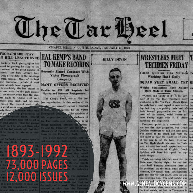
North Carolina. The first 100 years of the Daily Tar Heel newspaper are now free to search in digitized format at the North Carolina Digital Heritage Center. The collection spans 1893-1992 and includes over 73,000 pages from more than 12,000 issues. Click here for a related news article.
Ohio. FamilySearch also now hosts an index to Ohio, Crawford County Obituaries, 1860-2004, originally supplied by the county genealogical society. Obituaries may be searched or browsed; images may include additional newspaper articles (not just obituaries).
Utah and beyond (Latter-day Saint). The Church of Jesus Christ of Latter-day Saints (Mormons) has published a database of early missionaries. It covers about 40,000 men and women who served between 1830 and 1930, and may link to items from their personal files, including mission registry entries, letters of acceptance, mission journal entries, and photos. Those who are part of FamilySearch’s free global Family Tree will automatically be notified about relatives who appear in this database, and may use a special tool to see how they are related. Others may access the original database here. Click here to read a related news article.
Keep up with new and updated genealogy records online by subscribing to our free weekly email newsletter!

Disclosure: This post contains affiliate links and Genealogy Gems will be compensated if you make a purchase after clicking on these links. Thank you for supporting Genealogy Gems!

