Family Maps and Migration Routes Traced with New Tech Tools
 Family maps and migration routes can sometimes uncover new record finds and answer brick wall questions. It’s fast and simple to use these free tech tools to map your family’s history! I used them to track my ancestors as they trekked from the eastern seaboard to the Midwestern United States and found some fantastic leads!
There are two online treasures I have just discovered. FamilySearch and MyHeritage family trees can now be mapped with some neat interactive tools. MyHeritage just launched their PedigreeMap saying it is an “innovative way to view your family history,” and I think they are right. I have used migration maps to help me overcome brick walls and questions in my research for years. Using these free online tools have made it really fun and not difficult at all.
Creating Family Maps and Migration Routes at MyHeritage
PedigreeMap is free for all MyHeritage users. To access it, log on or create a MyHeritage account. If you are new to MyHeritage, you will be prompted to begin creating your free family tree when you click Sign up at the top right corner of their homepage.
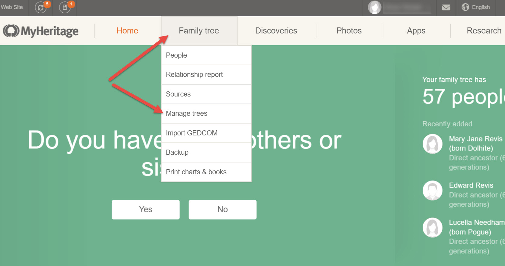
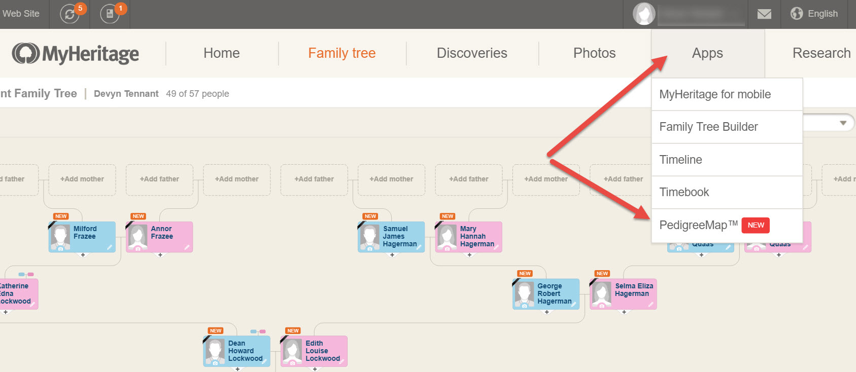
Once you have created your family tree, find it by clicking Family Tree and choosing Manage trees from the pull-down menu.
To use the PedigreeMap feature, choose your family tree from the list and then click on Apps and choose PedigreeMap from the pull-down menu.
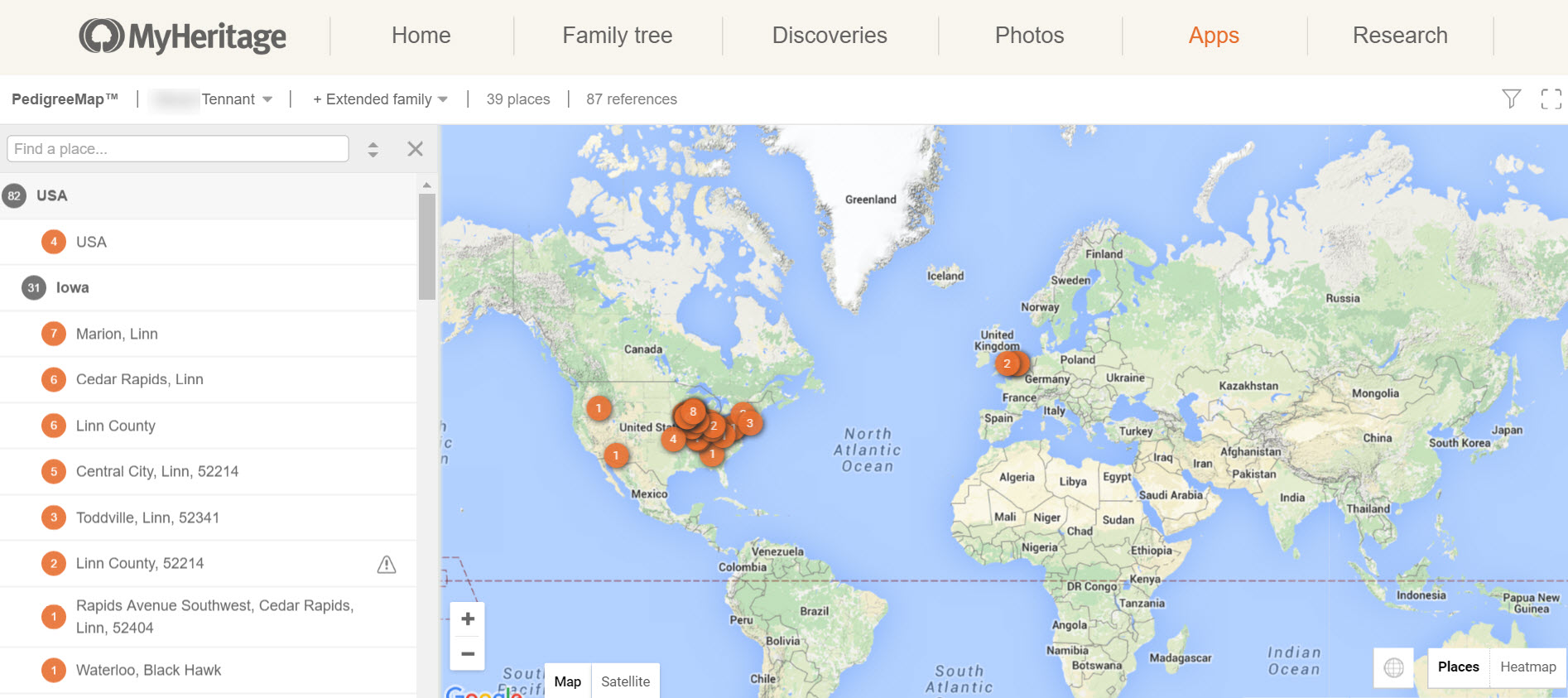
You will be able to see a map of the entire world in which your ancestors lives are plotted. From my map below, I can see the large concentration in the eastern half of the United States, but also the location of my ancestors from Europe.
Not only are genealogical events like births, marriages, and deaths plotted on your map, but if you put in a location of a picture, it will plot that too. You will notice, on the left-hand side there is a list of all the places that appear in your family tree. The numbers on the list match up to the number of each place in your family tree.
You can zoom in or zoom out, but my favorite part is clicking a location in the list to the left. For example, if I click on Marion, Linn, another list pops up on the right. This list shows me what events took place in Marion, Linn County, Iowa.
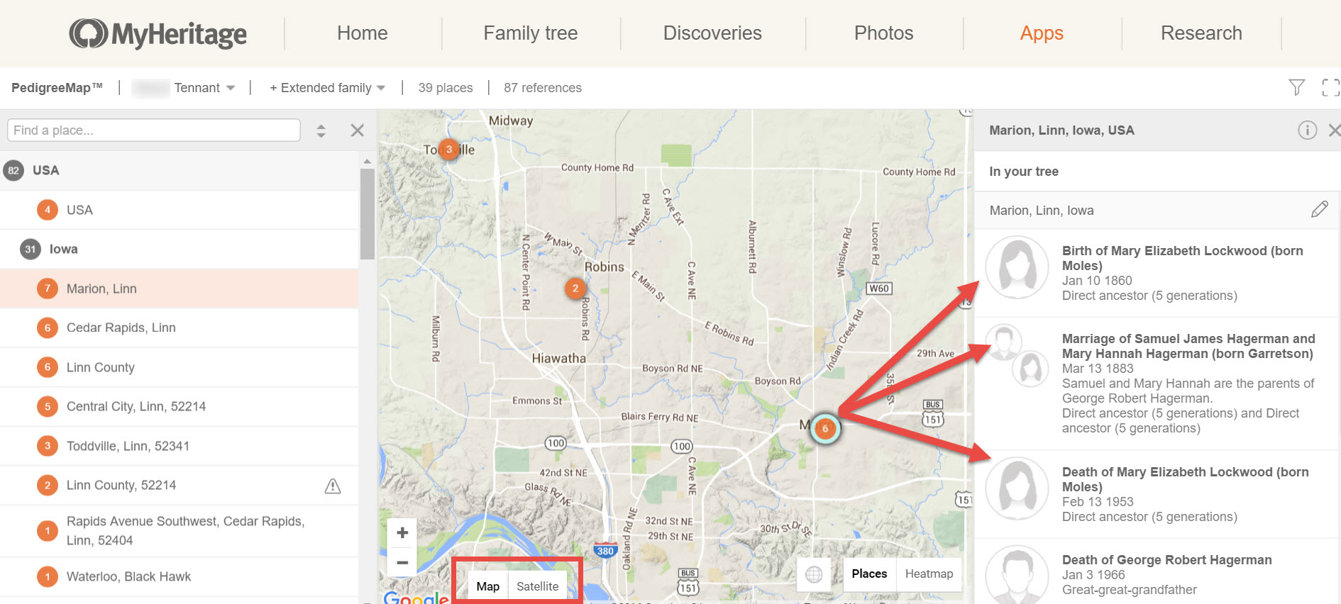
Additionally, I can see major roads, rivers, and hills. I can even click on the satellite view to see the street where my great-grandparents were married!
There are many more wonderful tools on PedigreeMap that you will want to check out. To learn more about all the unique features, read their article here.
Creating Family Maps and Migration Routes with FamilySearch
RootsMapper has been around awhile and is an interactive mapping website that works with FamilySearch. As you know, FamilySearch allows users to create a family tree online and search all their records for free. Like PedigreeMap, you will need to create your free account and family tree at FamilySearch. Then, go to the FamilySearch Apps page and click on RootsMapper. Now, click Get Started.
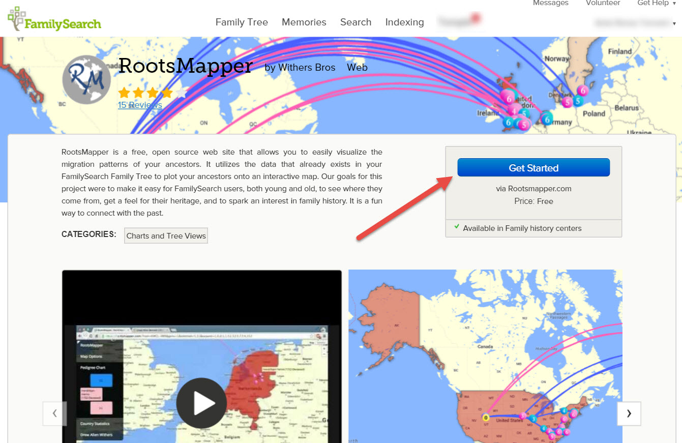
When you are redirected to the RootsMapper homepage, click Login to begin mapping. You will use your FamilySearch username and password. By clicking Accept, you give permission for RootsMapper to use your FamilySearch tree data.
The interactive map has various features. I particularly like the lines showing both the migration of my paternal line and my maternal line.
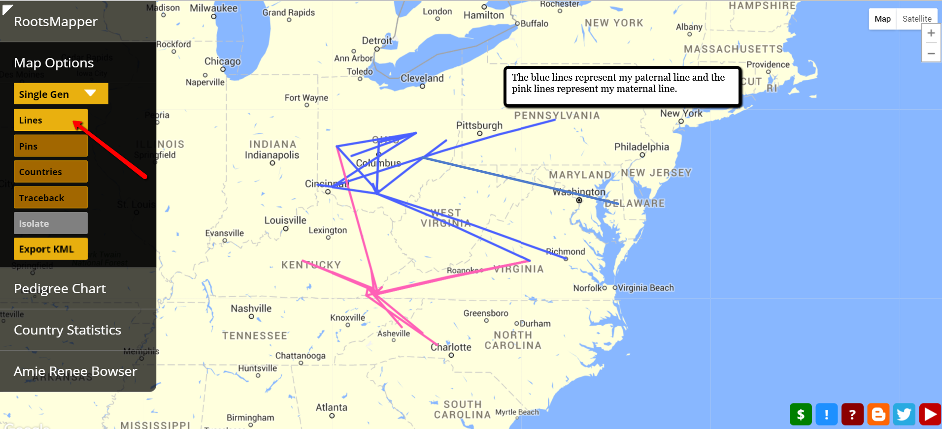
Did you notice my paternal line goes right through modern day West Virginia? Several years ago, I had “lost” my Walls family line. By plotting their known whereabouts on a map and connecting the dots, I could see possible migration routes. In fact, during that time frame, they likely took nothing but trails into Monongalia, Virginia. I did a search for records along this path and was surprised to find my fifth great grandfather on a tax roll for Virginia in 1790!
You can play around with the settings and map just one generation, five generations, or even ten generations. The options allow for pins, migration lines, changing the root person you are charting and much, much more.
It really is amazing how innovative genealogy research is today. The Genealogy Gems team delights in sharing new tech tools and tips to help you in your genealogy goals. Why not try out one of these family map and migration route tools today and share with us your thoughts? Leave a comment below!
More Gems on Mapping and Migration Routes
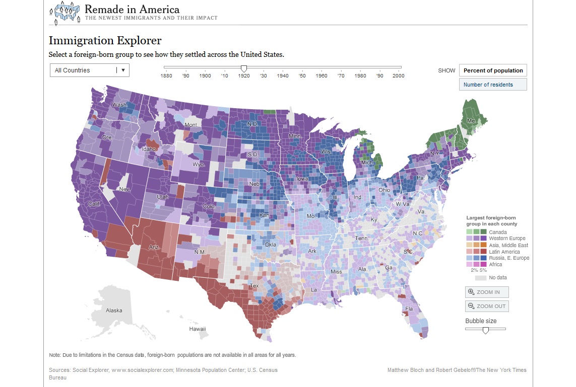
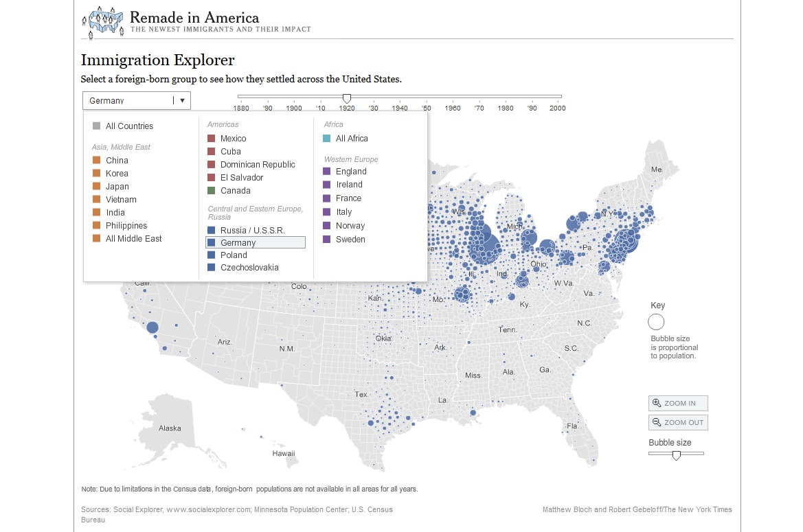
Mapping U.S. Migration Patterns
5 Ways to Enhance Your Genealogy Research with Old Maps (Premium Member Video)
3 Sources for Historic Maps That May Surprise You