by Lisa Cooke | Jul 3, 2015 | 01 What's New, Australian, British, Canadian, Census, Digital Archives, FamilySearch, Findmypast, images, Immigration, Memory Lane, Military, Photographs, Records & databases, United States

Every Friday, we blog about new genealogy records online. Do any of the collections below relate to your family history? Look below for early Australian settlers, Canadian military and vital records, the 1925 Iowa State Census and a fascinating collection of old New York City photographs.
AUSTRALIAN CONVICT RECORDS. Now Findmypast subscribers can access several collections on early settlers. Among them over 188,000 Australia Convict ships 1786-1849 records, which date to “the ships of First Fleet and include the details of some of the earliest convict settlers in New South Wales.” You’ll also find “nearly 27,000 records, the Australia Convict Conditional and Absolute Pardons 1791-1867 list the details of convicts pardoned by the governor of New South Wales and date back to the earliest days of the colony” and New South Wales Registers of Convicts’ Applications to Marry 1825-1851, with over 26,000 records.
CANADIAN WWI MILITARY RECORDS. As of June 15, 162,570 of 640,000 files are available online via the Soldiers of the First World War: 1914–1918 database on the Library and Archives Canada website. This is the first installment of an ongoing effort to digitize and place online records of the Canadian Expeditionary Force service files.
IOWA STATE CENSUS. About 5.5 million newly-added records from the 1925 state census of Iowa are now free to search at FamilySearch,org. Name, residence, gender, age and marital status are indexed. The linked images may also reveal parents’ birthplaces, owners of a home or farm and name of head of household.
NEW YORK CITY PHOTOGRAPHS. About 16,000 photos of old New York City from the New York Historical Society are free to view on Digital Culture of Metropolitan New York. According to the site, “The extensive photograph collections at the New-York Historical Society are particularly strong in portraits and documentary images of New York-area buildings and street scenes from 1839 to 1945, although contemporary photography continues to be collected.”
ONTARIO, CANADA VITAL RECORDS. Nearly a half million birth record images (1869-1912), nearly a million death record images (1939-1947) and over a million marriage record images (1869-1927) have been added to online, indexed collections at FamilySearch.
 Today’s list of new records has a LOT of Canadian material! If you’re researching Canadian roots, here’s a FREE video for you to watch on our YouTube channel: Lisa Louise Cooke’s interview with Canadian research expert Dave Obee, who shares 10 tips in his effort to help one RootsTech attendee break through her brick wall. This post and tip and brought to you by The Genealogist’s Google Toolbox by Lisa Louise Cooke, newly-revised and completely updated for 2015 with everything you need to find your ancestors with Google’s powerful, free online tools.
by Lisa Cooke | Oct 2, 2014 | 01 What's New, Digital Archives, History, images, Memory Lane
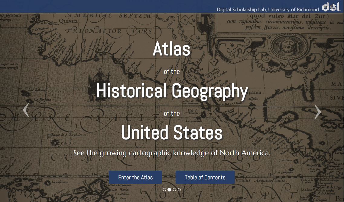
Atlas of the Historical Geography of the United States, http://dsl.richmond.edu/historicalatlas/.
Digital archives are getting so much better! They’re not just about reproducing historical documents anymore. Multimedia add-ons–from searchable statistics to animated timelines–fill in the gaps not explained by the map keys.
Recently, Slate.com writer Rebecca posted on some of her favorite digital archives. Four of the five are of interest to genealogists! Read the article to learn more about them:
 Want to learn more about using maps in your research? Watch my FREE class on Google Earth for Genealogy. Genealogy Gems Premium members can also watch my NEW video class online, 5 Ways to Enhance Your Genealogy Research with Old Maps. (Not a Premium member? Learn more here.)
by Lisa Cooke | Aug 8, 2014 | 01 What's New, Digital Archives, Google, Maps
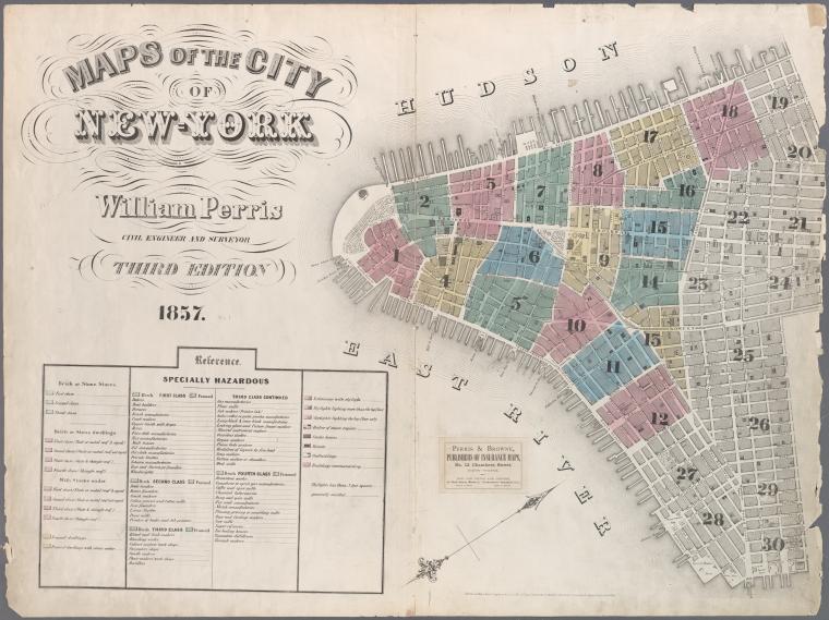
Map of New York City, 1857. Click for full citation information.
Thousands of historical maps of New York City, the mid-Atlantic states and even the Austro-Hungarian empire (yes, really!) are now online–and they’re free.
The New York Public Library has published more than 20,000 historical maps dating from 1660-1922. They are free for public use, downloading, manipulating and publishing! A lot of the maps are from New York City neighborhoods, like the one shown here.
The author of a news item about the collection said this: “We can’t imagine too many people wanting to remix Gangs of New York-era property charts, but it’s hard to object to getting more geographic knowledge at no charge.” Well, we genealogists may not “remix” these old property maps, but we can certainly see the value in them!
Do you use maps in your research? Have you tried overlaying a historical map showing an ancestor’s home with a modern one on Google Earth? Learn more about using Google Earth in your genealogy research in this FREE video.
And if this post is interesting to you, you should also read this blog post about interactive historical maps of major cities (like New York City).
by Lisa Cooke | Mar 24, 2014 | 01 What's New, History, NARA, Photographs
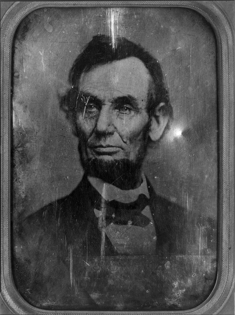
Daguerrotype of a Photograph of Abraham Lincoln, used for the $5 Bill. Original taken on February 9, 1864. Photographer unidentified [Public domain], via Wikimedia Commons.
Mystery photos are one of a family history researcher’s biggest frustrations. We find them in old albums, between the pages of books or in loose files. It can heartbreaking to wonder whether we’re looking at the face of an ancestor–and to know we may never know for sure.
Well, we’re not alone. Two news stories ran recently about old mystery photos theorized to be two icons of American history: President Abraham Lincoln and singer Elvis Presley!
(Image Right: Daguerrotype of a Photograph of Abraham Lincoln, used for the $5 Bill. Original taken on February 9, 1864. Photographer unidentified [Public domain], via Wikimedia Commons.)
Mystery Photos: Abraham Lincoln Funeral
The Washington Post recently posted a story about the possibility that some unidentified photos at the National Archives (U.S.) show rare images of Abraham Lincoln’s funeral procession in New York City.
The article gives some great back story how Lincoln’s 2-week+ funeral procession. His body traveled by rail and horse-drawn hearse for 1600 miles from Washington, D.C. back home to Springfield, Illinois. Along the way, there were stops for elaborate funeral processions in several cities. Millions of mourners turned out. The article quotes the man who put together this theory – a retired government accountant who loves historic photos.
Mystery Photo: A Young Elvis Presley?
The Blaze recently reported on an Elvis sighting: well, at least a photo sighting of Elvis. The image in question shows a young teenage boy. There are lots of questions about whether this is really The King before fame changed his life – and American pop music – forever.
These remind me of a genealogy blog post by Lisa Frank. She shares how listening to the Genealogy Gems Podcast led to the discovery of an online video that may belong to her family story. Read her post Could It Be My Ancestor? and chime in with your opinion.
What surprising, poignant or fascinating mystery photos have you found in your family history research? Share them on the Genealogy Gems Facebook page and tell us about them! I look forward to seeing them!
by Lisa Cooke | Jan 13, 2014 | 01 What's New, Google, Maps
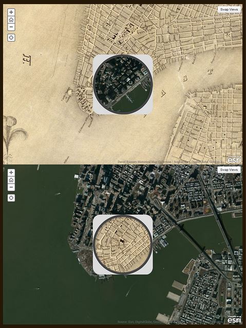
1836 map of New York City compared to modern satellite image, shown with each map in “spyglass” format. Image from David Rumsey Map Collection blog at DavidRumsey.com.
I love showing people how to use online tools to compare historical maps to modern ones. You can map out your ancestor’s address, check out their neighborhoods “then and now,” map their route to work, see if their old home still exists and more.
Well, the online Smithsonian magazine has created an exciting new interface for six American cities. Now you can compare modern satellite imagery with bird’s-eye views of:
You’ll see great city layouts before the fire that claimed much of old Chicago, the San Francisco earthquake, the Lincoln memorial and more. The historical map of New York City is the oldest, but the other maps capture each city at a critical point in their growth. For each city you can look at a historical map with a “spyglass” mouse-over of a modern satellite image, or vice-versa, as shown in the New York City map on the right. Each map is accompanied by a fantastic Smithsonian article; the historical maps come from the amazing David Rumsey Map Collection.
As many of you know, it’s possible to do something similar (or even better) with Google’s amazing mapping tools. Learn how to do that with these three Genealogy Gems resources:
1. My FREE Google Earth Video, which teaches you how to unlock mysteries in your research, from unidentified photographs to pinpointing homesteads;
2. My Google Earth 2-Disk Bundle, with detailed demonstrations and examples so you can SEE for yourself how to use Google’s mapping tools;
3. My new Time Travel with Google Earth video, in which you’ll see old maps, genealogical records, images, and videos come together to create stunning time travel experiences in Google Earth. This is available to Genealogy Gems Premium Members (learn more membership here).

 Today’s list of new records has a LOT of Canadian material! If you’re researching Canadian roots, here’s a FREE video for you to watch on our YouTube channel: Lisa Louise Cooke’s interview with Canadian research expert Dave Obee, who shares 10 tips in his effort to help one RootsTech attendee break through her brick wall. This post and tip and brought to you by The Genealogist’s Google Toolbox by Lisa Louise Cooke, newly-revised and completely updated for 2015 with everything you need to find your ancestors with Google’s powerful, free online tools.