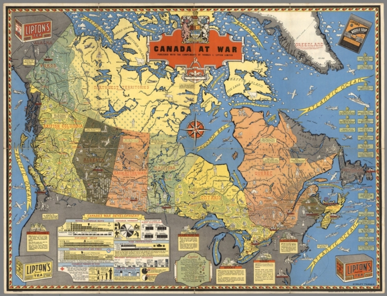
Canada at War by Stanley Turner, 1944. Online at the David Rumsey Map Collection. Click on image for full citation and to access image.
During World War II, millions of people anxiously followed the progress of battles and troop movements that affected their loved ones. Artists and map-makers stepped up to provide colorful, action-packed maps.
Toronto artist Stanley Turner was one of these. He created a series of maps between 1942 and 1945 that were printed and licensed as promotional giveaways to businesses in Canada and the U.S. Today you can find Turner’s maps digitized at the David Rumsey Map Collection.
Stanley wasn’t the only one making these beautiful maps. Read about Richard Eddes Harrison and the big changes in popular cartography during the war in my blog post, “World War II: A Revolution in Map-Making.”
Fast-forward 60 years in time, and the latest revolution in map-making and information-sharing is where? On Google Earth! Google Earth is packed with topography, but also shows us man-made features like roads and bridges, geographic boundaries, historical maps and photographs and so much more. These help us understand things like movements of our ancestors–whether they were troops in World War II or settlers in distant places.
Want to learn more about using Google Earth for genealogy (or the Google Earth Pro version that was just released FREE to the public)? Become a Genealogy Gems Premium member. You’ll have access to video classes like these:
Time Travel with Google Earth
5 Ways to Enhance Your Research with Old Maps (this class’ retail value alone is $39.95)
Premium Membership is a bargain at only $29.95 for an entire year’s access, plus right now you get the free bonus ebook Lisa Louise Cooke’s 84 Best Tips, Tricks & Tools from Family Tree Magazine. Click here to learn more about Premium Membership.
Do you love old maps? Then you might enjoy a new video presentation now online at the Library of Congress website on the history of mapmaking and some thoughts about cartography in the future.
According to the website, “From Terra to Terabytes” Map Symposium presents “a sweeping view of the field, as it went from traditional methods of surveying in early years to remote-sensing and computer cartography of more recent years. They also discussed the future of cartography.”
Four sessions are available online. Watch the first session below:
Are you a Genealogy Gems Premium member? If so, you can learn a lot more about how to use old maps in your genealogy research! Your low annual membership gets you access to five video classes, including 5 Ways to Enhance Your Genealogy Research with Old Maps. In this Premium Video you will learn which historical maps every genealogist should use; some of the best online resources for finding old maps; how to locate offline historical maps; how to create and save your own historical map collection and techniques for using old maps in your research.
The Abbeville press and banner., October 12, 1892, Image 6/ www.chroniclingamerica.com
When Liberian national Thomas Eric Duncan was diagnosed with Ebola it was unnerving for everyone here in the U.S. As a new Dallas area resident, and someone who was hopping from plane to plane for a Fall series of speaking engagements, it definitely gave me pause.
Epidemics, quarantines, and communities trying to protect citizens have been age old dilemmas, so it makes sense to look back through history at the strategies employed. There is much to be learned.
If we ask the question “what would have happened if Ebola had struck the U.S. 130 years ago?” we don’t have to look much farther than the location of one of the most recent Ebola patient: New York.
from the Humboldt Republican (Humboldt, Iowa) March 31, 1892 Courtesy www.Newspapers.com
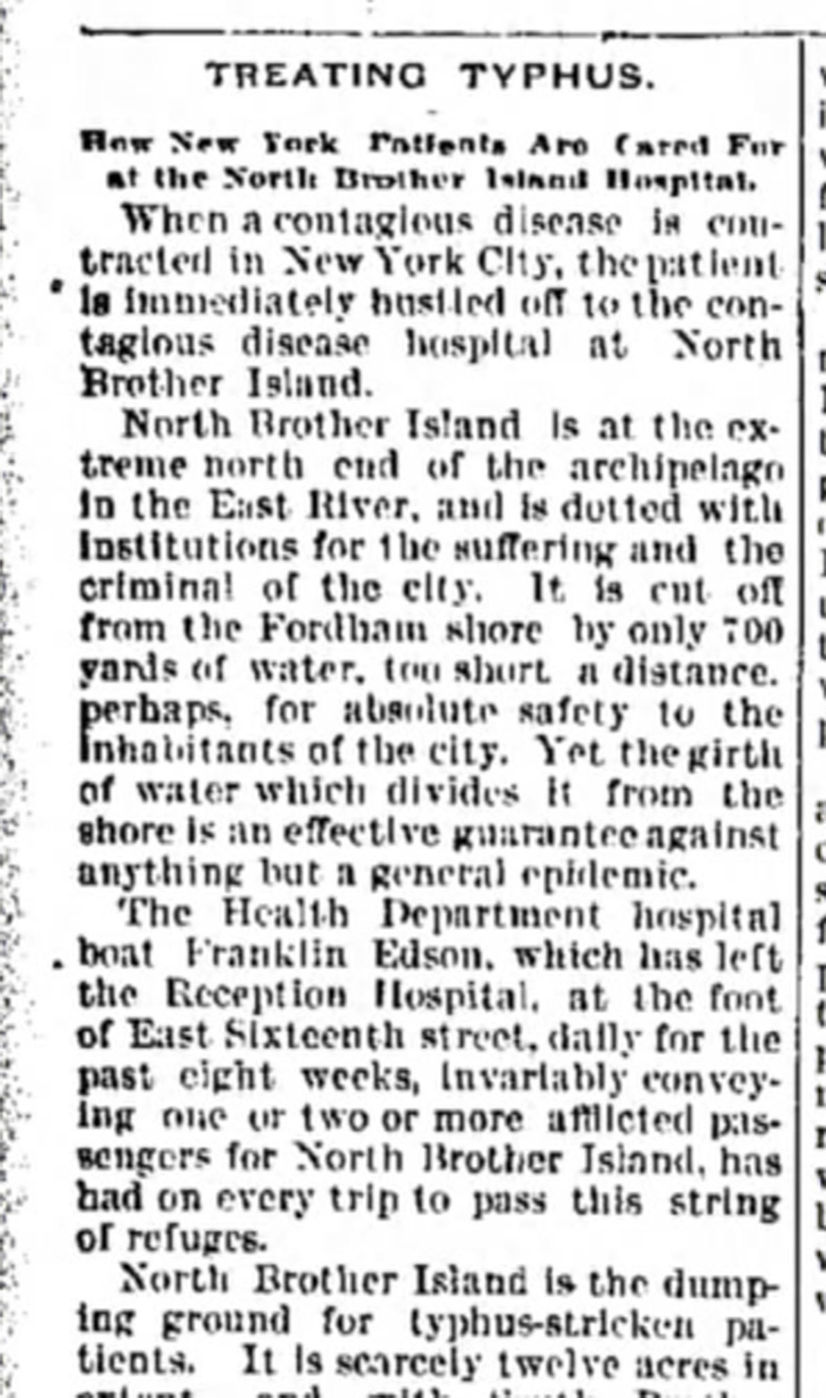
In New York’s East River, tucked between the Bronx and Rikers Island lies North Brother Island, where in 1885 Riverside Hospital was relocated from Blackwell’s Island to isolate and treat small pox patients. From there it expanded to include the quarantine of other diseases.
North Brother Island stands idle today, closed to the public. However from 1907-1910 and 1915-1938 it housed the notorious Typhoid Mary, closing shortly after her death.
Although today the island is closed to the public, anyone can visit virtually with the aid of Google Earth. Join me on a 5+ minute tour of North Brother Island featuring the magazine and newspaper articles of the day, and written, audio and video tours of how it stands today a shell of what it once was. Click here to download and play my Google Earth Historic Tour KMZ file on your computer. It will be added to your “Places” panel in Google Earth under “Temporary Places.” Open the folder and click the “click to play the tour” icon. Be sure your speakers are on! And take time to click to watch the video and view the articles in the placemarks.
Recently we heard from Gordon in Billings, Montana, U.S.A, who passed on news about historical Norwegian maps online now at their National Map Works. He says:
“I have been enjoying your podcasts for a couple of years now, so I though I would pass on a piece of information that some of your listeners might want to hear about.
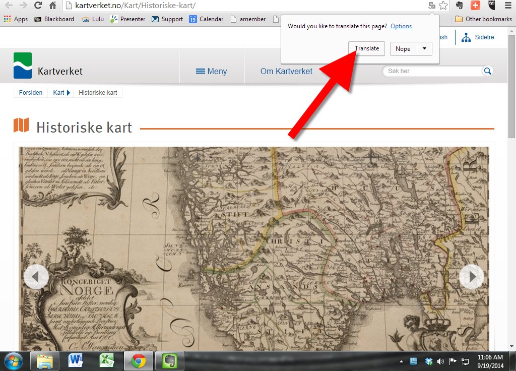
I don’t know how many of them do research in Norway like I do but I suspect that most of the ones that do, do not make a habit of reading the Norwegian newspapers. Since my wife was born in Norway, we do read her hometown paper on a regular basis. Just yesterday, that paper, Bergens Tidende, had an article reporting that the “Statens Kartverk” (the National Map Works) has recently digitized and posted on-line 8000 historical maps of Norway. (Click here for the article.)
Unfortunately, the website for the maps has not put a link in their English section yet, but there isn’t much to read beyond place names on the maps anyway. You can view the maps here.
Just choose a county, click the green button, and see a wonderful collection of maps for anyone with ancestors from Norway.”
Thanks for the tip, Gordon! I’ll add this tip of my own: Open the website in Chrome and Chrome will automatically offer to translate the website. Simply click the Translate button, like you’ll see below:
Do you ever get lost when looking for ancestral hometowns in Europe or other parts of the world? Boundaries change–national ones as well as regional ones. Place names change. Several little villages may all have gone by the same name over time. And darn those spelling and place name variants!
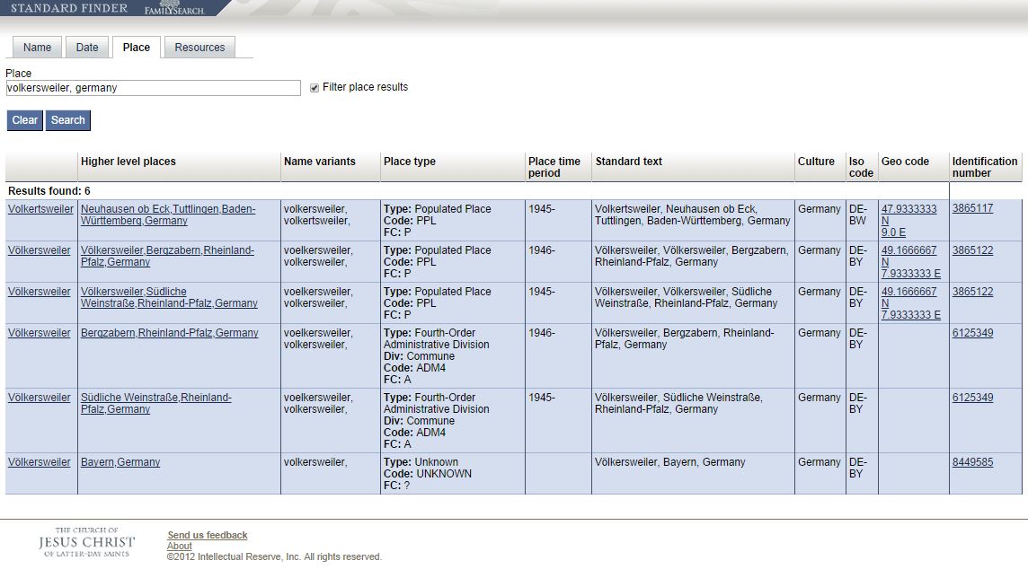
There’s a great online tool for finding places on a map. It’s the FamilySearch StandardFinder. Under the Place tab, enter the place name that’s got you befuddled. You’ll get a result screen that looks something like this:
What do each of those columns mean? We asked a Product Manager at FamilySearch and here’s what he told us:
Column 1: The official name of the place.
Column 2: Link/official name to the jurisdiction that the place exists within.
Column 3: “Normalized” variant names (i.e. other names the place is known by)
Column 4: General/high-level type (the type) of the place. Div: The more specific type (if applicable). Code: The code for the general type. FC: The feature code (taken from NGA’s feature code).
Column 5: The years within which the place existed (typically within the jurisdiction it belongs to).
Column 6: The full official (standardized) name of the place and its jurisdiction.
Column 7: Culture: The generalized culture that the place exists within.
Column 8: ISO code: The ISO code (if applicable).
Column 9: Geo code: the “centroid” (or central spot) of the place specified as the latitude and longitude.
Column 10: The permanent identifier of the place, useful for referencing the place within applications, systems, and products.”
A couple of these columns are a little technical for me, but I can still extract a LOT of information from these results! Place names, variant names, jurisdictions, lifespan of that location, latitude/longitude and all the possible places a possible location might be.
You’ll likely notice that there are Standard Finders for names and dates, too!
 Want to learn more about using Google Earth for genealogy (or the Google Earth Pro version that was just released FREE to the public)? Become a Genealogy Gems Premium member. You’ll have access to video classes like these:
 about cartography in the future.
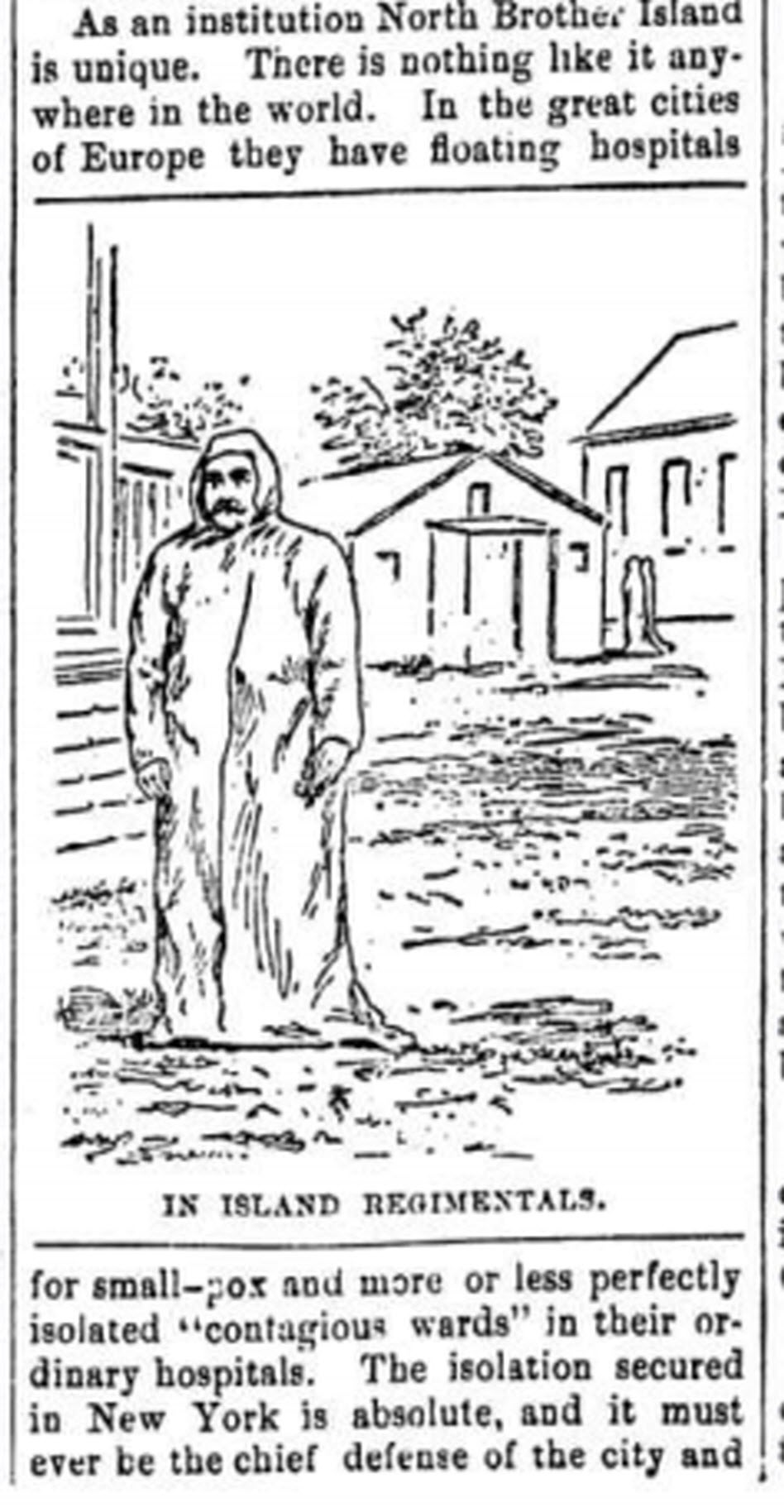
 Works. He says: