by Lisa Cooke | Sep 17, 2014 | 01 What's New, Apps, History, Holidays, NARA
Today the United States celebrates Constitution Day! On this date in 1787–225 years ago–delegates finalized and signed the historic document that  became the U.S. Constitution.
In celebration, the National Archives Center for Legislative Archives has launched a free mobile app, e-book and even companion tools for teachers: lesson plans and teaching activities.
“Congress Creates the Bill of Rights” is described at the National Archives website, where you can download the e-book and teaching resources. The e-book is also available in iTunes and the iBookstore for iPad, iPhone, and iPod Touch. The app is available for download on iPad at the App Store.
A press release describes the app as “an interactive learning tool for tablets that lets the user experience the proposals, debates, and revisions that shaped the Bill of Rights in the First Congress. Its menu-based organization presents a historic overview, a one-stop source that includes the evolving language of each proposed amendment as it was shaped in the House and the Senate, a close-up look at essential documents, a ‘time-lapse’ display of the creation of the First Amendment, and more.
Congress Creates the Bill of Rights eBook presents a historic narrative focusing on James Madison’s leadership role in creating the Bill of Rights and effectively completing the Constitution. Starting with the crises facing the nation in the 1780s, the narrative traces the call for constitutional amendments from the state ratification conventions, and takes the reader inside Congress as the House and the Senate worked to formulate a set of amendments to send to the states.”
Did you have ancestors who were at the Constitutional Convention? Contribute what you know at the Signers of the U.S. Constitution Project at Geni.com. The goal of this project is to build “single, documented profiles” of those who signed.
by | Sep 6, 2014 | 01 What's New, Book Club, Google, Google Earth, History, Maps, NARA
 Did you ever watch or read the “Little House on the Prairie” series? It certainly fired my childhood imagination and my lifelong love for history. The stories are based on a series of written-for-kids-but-loved-by-everyone books by Laura Ingalls Wilder. Her family helped settle the western American frontier in the late 1800s.
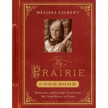
Now “Little House” is coming back to life in the form of a cookbook by Melissa Gilbert, who played young Laura Ingalls in the NBC television series (1974-1983). Melissa has published My Prairie Cookbook: Memories and Frontier Food from My Little House to Yours .
.
In My Prairie Cookbook, Melissa dishes up comforting family recipes and childhood favorites. There are prairie breakfasts, picnic lunches and treats inspired by Nellie’s restaurant (from the Little House series). Eighty delicious dishes—crispy fried chicken, pot roasts, corn bread, apple pie, and more—let you eat like the Ingalls family! The book is garnished with Melissa’s “Little House” memories and memorabilia, including behind-the-scenes stories, anecdotes, and scrapbook images.
Laura’s Early Years in Google Earth
Often when I’m teaching about how to use Google Earth for genealogy, and in particular, how to create what I call “Family History Tour,” I use Laura’s early life as an my example. Almost everyone is familiar with the story: she was born in Wisconsin, and moved to states like Missouri, Kansas, and Minnesota during her lifetime. Seeing it come together in a virtual tour brings a new tech element to a beloved historical story.
 You can download a quick Google Earth Family History Tour of her early years by right-clicking this link and downloading the KMZ file to your computer. Click the file, and it will launch Google Earth and save the tour to your “Temporary Places” at the bottom of the Places panel on the left side of the screen. Click the arrow to open the folder (image right)
Inside the folder double click the “movie camera” icon at the top of the list to play the tour.
The tour will navigate from the Little House in the Big Woods of Pepin, Wisconsin, (with a stop to read the History of Pepin ebook right from the map if you so desire), to Rutland, Montgomery, Kansas as the family was documented in the 1870 U.S. Federal Census, and Laura was just 3 years old.
This short tour, filled with street views, videos, genealogical documents and even digital history books provides a taste of what you can accomplish with your own family. To learn more click here to watch my free introductory Google Earth for Genealogy video class.
Explore Little House in the Big Archives
Next week, The National Archives will host a program about the new cookbook with Melissa Gilbert. Why have a cookbook featured at the National Archives? Because its inspiration–the Ingalls family–was a real part of U.S. history and the National Archives houses many documents about their lives
by Lisa Cooke | Apr 2, 2014 | 01 What's New, Maps, Research Skills
Looking for enumeration district maps for the U.S. Federal Census? You’re not alone! Recently Genealogy Gems podcast listener Michelle in Denver,
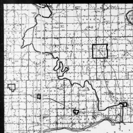
1940 Census Enumeration District Map, Oklahoma, Wagoner County, http://research.archives.gov/description/5836456
Colorado, wrote in with this question:
“Where can I find individual enumeration district maps? I don’t need a state-wide map showing the divisions between enumeration districts, but a map showing the numbered households within a single enumeration district.”
My answer: How to find Enumeration District Maps
First, here’s a little back story from the National Archives (U.S.) website:
“An enumeration district, as used by the Bureau of the Census, was an area that could be covered by a single enumerator (census taker) in one census period. Enumeration districts varied in size from several city blocks in densely populated urban areas to an entire county in sparsely populated rural areas.
Enumeration district maps show the boundaries and the numbers of the census enumeration districts, which were established to help administer and control data collection. Wards, precincts, incorporated areas, urban unincorporated areas, townships, census supervisors` districts, and congressional districts may also appear on some maps. The content of enumeration district maps vary greatly.
The base maps were obtained locally and include postal route maps, General Land Office maps, soil survey maps, and maps produced by city, county, and state government offices as well as commercial printers. Census officials then drew the enumeration district boundaries and numbers on these base maps.” (Check out the full article here.)
Enumeration district maps are not available in all years and all locations. 1940 is the most accessible. These are available on the National Archives (U.S.) website. (Scroll down to item 3 for instructions on getting to these through the Online Public Access search.) You’ll see that only the enumeration district numbers and street names are marked on the maps. Individual homes are not.
What about enumeration district maps before 1940? Consult Cartographic Records of the Census Bureau for maps in the National Archives.
For censuses before 1900, the government used voting districts as enumeration districts. Find voting district maps in the Library of Congress book, Ward Maps of the United States : A Selective Checklist of Pre-1900 Maps in the Library of Congress. (The links here lead to WorldCat search results for these titles. WorldCat will tell you about libraries that have these books.)
If you just want to find the enumeration district number of an address you already know, go to the Unified Census ED Finder at Steve Morse’s One-Step genealogy website.
Here are a couple more thoughts:
- In cities, there are often two columns of numbers in the census population enumeration (typically on the far left of the page). There’s house number and the number representing the order in which the enumerator visited the house (which has nothing to do with the house number). If you can’t find a relative in once census, pull the address from one census and use it in the Steve Morse database above to pull up the enumeration district for your missing decade.
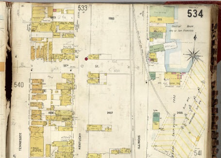
- Depending on the year you are researching, try to locate a Sanborn fire insurance map for the area. Sanborn maps do include drawings of individual homes and include their house number. Genealogy Gems Premium Podcast Episode 47 is all about Sanborn fire maps. On the show notes page I even include a list of links to many Sanborn map collections, organized by state.
by Lisa Cooke | Mar 24, 2014 | 01 What's New, History, NARA, Photographs
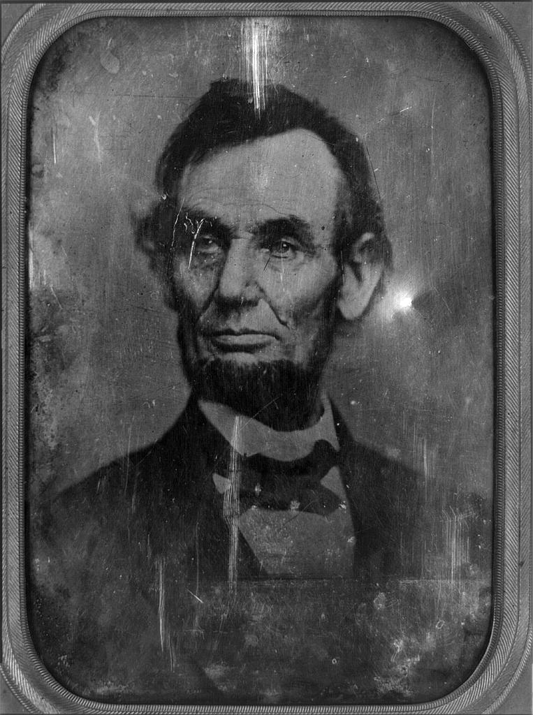
Daguerrotype of a Photograph of Abraham Lincoln, used for the $5 Bill. Original taken on February 9, 1864. Photographer unidentified [Public domain], via Wikimedia Commons.
Mystery photos are one of a family history researcher’s biggest frustrations. We find them in old albums, between the pages of books or in loose files. It can heartbreaking to wonder whether we’re looking at the face of an ancestor–and to know we may never know for sure.
Well, we’re not alone. Two news stories ran recently about old mystery photos theorized to be two icons of American history: President Abraham Lincoln and singer Elvis Presley!
(Image Right: Daguerrotype of a Photograph of Abraham Lincoln, used for the $5 Bill. Original taken on February 9, 1864. Photographer unidentified [Public domain], via Wikimedia Commons.)
Mystery Photos: Abraham Lincoln Funeral
The Washington Post recently posted a story about the possibility that some unidentified photos at the National Archives (U.S.) show rare images of Abraham Lincoln’s funeral procession in New York City.
The article gives some great back story how Lincoln’s 2-week+ funeral procession. His body traveled by rail and horse-drawn hearse for 1600 miles from Washington, D.C. back home to Springfield, Illinois. Along the way, there were stops for elaborate funeral processions in several cities. Millions of mourners turned out. The article quotes the man who put together this theory – a retired government accountant who loves historic photos.
Mystery Photo: A Young Elvis Presley?
The Blaze recently reported on an Elvis sighting: well, at least a photo sighting of Elvis. The image in question shows a young teenage boy. There are lots of questions about whether this is really The King before fame changed his life – and American pop music – forever.
These remind me of a genealogy blog post by Lisa Frank. She shares how listening to the Genealogy Gems Podcast led to the discovery of an online video that may belong to her family story. Read her post Could It Be My Ancestor? and chime in with your opinion.
What surprising, poignant or fascinating mystery photos have you found in your family history research? Share them on the Genealogy Gems Facebook page and tell us about them! I look forward to seeing them!
by Lisa Cooke | Mar 17, 2014 | 01 What's New, Libraries, NARA
National Archives (US) facilities are closing or restructuring in three locations. But steps are being taken to maintain access (local or online) to the
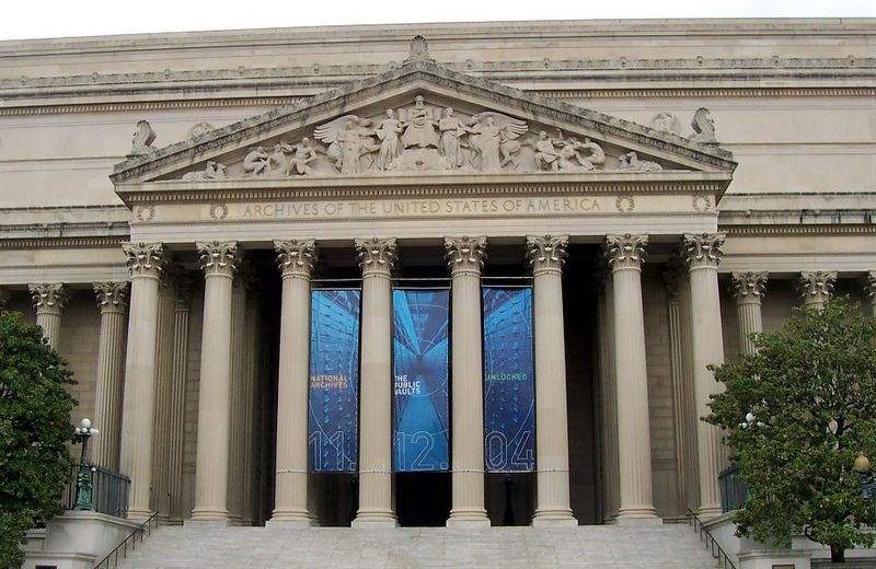
National Archives, Washington, D.C. Wikimedia Commons Image by Edbrown05.
treasure trove of research materials at these facilities.
A recent press release states, “As part of ongoing budget adjustments, Archivist of the United States David S. Ferriero announced the permanent closure of three National Archives facilities. This year, the National Archives facility in Anchorage, AK, will close and two facilities in the Philadelphia, PA, area will be consolidated to a single site. Within the next two years, two Archives’ facilities in Fort Worth, TX, also will be consolidated to a single site. These closures and consolidations will result in estimated annual cost savings of approximately .3 million.”
“The National Archives budget is devoted primarily to personnel and facilities, both of which are essential to our mission,” the Archivist stated. “I recognize these cuts will be painful; however, we are committed to continuing to provide the best service to our customers and best working conditions for our staff nationwide.”
Here’s the scoop on each of the affected locations:
National Archives – Anchorage, AK, facility closing:
The National Archives’ facility in Anchorage, AK, will close permanently in FY 2014. The employees who work there will be offered positions at other National Archives facilities, with the National Archives paying relocation expenses. The less than 12,000 cubic feet of archival records in Alaska will be moved to the National Archives at Seattle, WA, where the National Archives will digitize these records so that they remain available to Alaskans through the internet. In addition, we will move approximately 7,500 cubic feet of records center holdings to Seattle, WA.
National Archives – Philadelphia, PA, facility consolidation:
The National Archives currently maintains two facilities in Philadelphia—a records center and archives at Townsend Road, and a small “storefront” archival facility at 900 Market Street in the city center. These facilities are in the same commuting area, and archival records are currently moved between the two for research use. The Market Street facility will close in FY 2014, and those employees will move to Townsend Road or telework locations. The less than 5,000 cubic feet of archival records stored at Market Street will be moved to Townsend Road, where the majority of the archival records already are stored. The Townsend Road facility’s research room will be modified to better provide appropriate access to researchers, and community outreach programs will continue.
National Archives – Fort Worth, TX, facility consolidation:
The National Archives currently maintains two facilities in Fort Worth: a combined records center and archives at John Burgess Drive, and a smaller “storefront” facility at Montgomery Plaza. The National Archives will permanently close the Montgomery Plaza facility in FY 2016. All employees at the Montgomery Plaza location will move to John Burgess or telework locations. No original records are stored at Montgomery Plaza, and researchers will have continued access to archival records through the research room at John Burgess Drive.
What’s at National Archives facilities for family history researchers? Learn more here.
 became the U.S. Constitution.

 You can download a quick Google Earth Family History Tour of her early years by right-clicking


