Google Maps Street View Delivers a Taste of Time Travel
Google Maps Street View was given an edge today over Google Earth’s street view when Google launched a “time travel” upgrade. The ability to time travel is high on most family historians list, and Street View imagery for Google Maps desktop provides a taste of that prize.
According to Google’s blog post today they have “gathered historical imagery from past Street View collections dating back to 2007 to create this digital time capsule of the world.”
Here’s an example of viewing Gettysburg with the new feature. In many cases, there’s nothing earth shattering to see. But in some locations which have undergone substantial change in that short time period (such as viewing the reconstruction after the devastating 2011 earthquake and tsunami in Onagawa, Japan) the results are riveting.
Don’t worry if you don’t see Google Maps Street View Historical Imagery feature yet. When you have millions of users it can take a while to roll out upgrades.
Members Have Been Time Traveling for a While Now
If you’re a Genealogy Gems Premium Member then chances are you made a bee-line for the Time Travel with Google Earth premium video as soon as you joined. In that video we explore some incredibly powerful ways to travel back through our ancestor’s lives and times. And while I still think that those techniques deliver more relevant results for genealogists, this new Street View time travel in Google Maps is exciting in its own way. It offers a glimpse into the future.
Consider this: Google has been amassing incredible amounts of data over its short life including satellite and street view imagery. 7 years in and they can now begin to offer this collection of older imagery in a meaningful way. Imagine what historical street view imagery will look like in 10, 25, or 50 years from now!
After Looking Back in Time, I Offer This Prediction for the Future
While this feature has just rolled out in Google Maps, and is not yet available in our beloved Google Earth, I predict this omission will not last long. You may have already noticed that as you zoom in closer to street level in Google Earth a small clock icon appears at the bottom of the screen indicating historical satellite imagery is available. Next to the icon a date now appears indicating the earliest available imagery. Click the Historical Imagery icon in Google Earth’s toolbar and a time slider indicating the years available will appear.
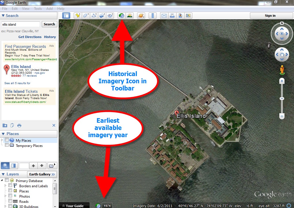
For most areas of the world this spans about as long as satellite imagery has been around. But in some key areas, such as London and parts of Europe, the slider goes back to the World War II era. Black and white aerial imagery of war torn areas are plainly visible. (If you have World War II veterans in your family tree, this is a feature you’ll want to explore.) It can only be a matter of time before this same Historical Imagery comes to Google Earth’s Street View.
 More Ways to Explore and Time Travel Now
If you are intrigued by the idea of using this technology to simulate your own genealogical time travel experience, watch my free video called Google Earth for Genealogy. You’ll travel along with me as I uncover the secrets of a photograph taken just over one hundred years ago, pinpoint the location today, and then travel back in time to further explore my ancestor’s neighborhood. From there, the sky is the limit with Google Earth and Google Maps!