by Lisa Cooke | Oct 18, 2013 | 01 What's New, British, Canadian, Google, Inspiration, Maps
Gail Rogers in Ottawa, Ontario, Canada recently shared how my presentation on using Google Earth for genealogy helped her find her way to the site of an old family business–and the place where her ancestor died. She’s given me permission to share it with you. I hope you find it as inspiring as I do!
“Just last week, I received an 1879 death certificate for my great-great-great-grandmother. She ran The Castle Inn in Stafford, Staffordshire, England after the death of her husband in 1863. To my sorrow and horror, I learned that she hanged herself probably within the establishment where she also lived!
“When I shared this with a group of English and Australian cousins who are also researching this family, one of them sent me a link to a 1960s photo of The Castle Inn, shortly before its demolition:
“Then I remembered your presentation about pinpointing your ancestor’s home in San Francisco. I’ve had several “family history” maps with icons that I’ve been working on for the past five years at Google Maps, so I went to the one for my Staffordshire ancestors, clicked on my icon for Eastgate Street in Stafford, and used the Street View to wander down the street, looking for the outline of the roofs, as you did with your old family photo. (You can view a video of my Google Earth for Genealogy class for free here on my website that demonstrates this technique.)
“I soon spotted the outline at the extreme left of the photo, “turned around” (virtually) and wham! There were the double Elizabethan-style timber-framed gables, just as they appeared in the older photo!”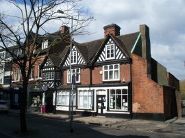
Gail, I was so glad to read that this helped you. I’ve gotten so much great feedback on that particular example of how to use powerful Google Earth (and Google Maps) tools to find important family landmarks.
 The presentation she’s talking about can be found in The Genealogist’s Google Toolbox Kit, a value bundle that includes my book The Genealogist’s Google Toolbox and Volumes I and II of Google Earth for Genealogy (on video CD). Even better, right now that kit is available for 20% off! The 2 discs are also available as a bundle on their own. And thanks, Gail, for sharing your success with us!
by Lisa Cooke | Apr 8, 2015 | 01 What's New, Google, Research Skills
This just in! Google Scholar and ProQuest are teaming up to provide a publicly-accessible index to all of ProQuest’s scholarly journal content. Google Scholar already delivers search results on your favorite genealogy keywords (names, places and records) from scholarly publications like dissertations, academic articles and more. (Click here to read my blog post about Google Scholar for genealogy.)
Now the search experience will become more powerful and inclusive. According to a press release, “ProQuest will enable the full text of its scholarly journal content to be indexed in Google Scholar, improving research outcomes. Work is underway and the company anticipates that by the third-quarter of 2015, users starting their research in Google Scholar will be able to access scholarly content via ProQuest.”
“ProQuest has rich, vast content that advances the work of researchers, scholars and students,” blogged the CEO of ProQuest. “Respecting the different ways researchers and librarians choose to conduct their research is essential to ensuring that content is simple to discover and use. We know Google Scholar is a popular starting point for researchers of all kinds. Our teamwork with Google will enable these patrons to be automatically recognized as authenticated ProQuest users and seamlessly link to their ProQuest collections, where they can connect with full-text scholarly content.”
It appears that there will still be a charge to access copyright-protected material (“authenticated ProQuest users” in the quote above are those that have access via a ProQuest subscription). According to the press release, “Users who are not recognized will be sent to a landing page with the abstract or an image of the first page, protecting all rights holders. To read full text, the users will authenticate themselves. There is nothing for libraries to set up – the linking will be seamless and automatic.”
 Learn more about using Google Scholar and other advance Google search techniques to discover your family history online in The Genealogist’s Google Toolbox Second Edition. The newly-updated and fully-revised book is available now!
by Lisa Cooke | Apr 9, 2018 | 01 What's New, Listeners & Readers, Maps
You can now see New York City street views from the late 1800s and early 1900s as Google Earth street views. Take a virtual visit to the Big Apple as it was 100 years ago! Or travel back even further in time to an 1836 map of NYC conveniently overlaid on a modern Google Earth view. These are just two of the many ways to use Google Earth for genealogy—and for fun.

Vintage New York City Street Views on Google Earth
Over 80,000 original photos from the late 1800s and early 1900s have been mapped into Google Earth to provide what’s essentially a Google Street View map of old New York City!
The site is called OldNYC, and it’s free.
As you can see from this overview map (below), the old photos are concentrated in the areas of Staten Island, Brooklyn, Queens and Lower and Upper Manhattan. Dots represents historic photos that have been overlaid on Google Earth’s modern map (satellite view is also available).
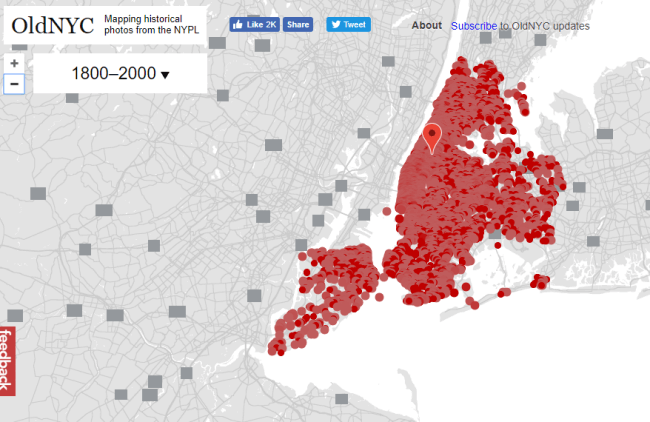
Old NYC
You can zoom in to click on individual dots, which will bring up one or more individual photos of certain neighborhoods or street fronts:
Select the photos that match up best with your family history interests, such as a shot of your family’s old store front or apartment building. Or choose images that represent the time period in which your relatives lived in the area, so you can get a flavor of what their neighborhood would have looked like. (Click here for some ideas about where to look for your family’s exact address during the late 1800s or early 1900s.)
These photos all come from the New York Public Library’s Photographic Views of New York City, 1870s-1970s collection, which is also free to view online.
According to this article at BusinessInsider.com, a developer Dan Vanderkam worked with the New York Public Library to plot all the photos onto Google Earth. (A hat-tip to Genealogy Gems listener and reader Jennifer, who sent me this article because she knows how much I love old maps and data visualization!)
Another Old NYC Street View: 1836 Map
While we’re on the subject, I also want to mention another cool tool for visualizing old NYC street views. At the Smithsonian.com, there’s a cool historic map overlay of an 1836 New York City map in Google Earth. Use the scrolling and zooming tools to explore the parts of NYC that were already settled–and to compare them to what’s there today. You can also swap views to see the 1836 map with just a little round window of the modern streets.
The accompanying article quotes famous map collector David Rumsey about the 1836 map, which is his. He describes how you can see that much of the topography of Manhattan has changed over the years—did you know Manhattan used to be hilly? And I love how he calls out artistic features on the old map, too.
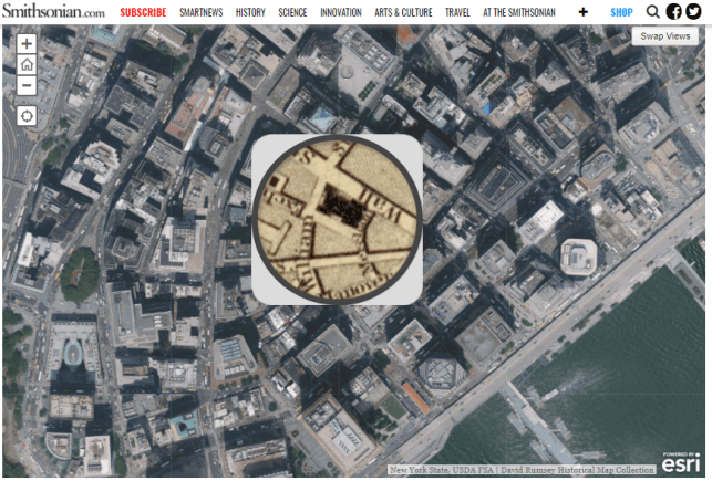
Smithsonian NYC street view 1836
Unfortunately, the old map doesn’t show much in the way of residents’ property lines or buildings. But you can clearly see the street layouts and where the parks and hills were. Comparing these areas with Google Earth’s street view today can help you better understand what things looked like in a much older version of one of the world’s great cities.
Use Google Earth for Your Genealogy
There are so many ways to use Google Earth for genealogy! My free video class will get you started. After a quick tutorial on downloading and navigating Google Earth, see how to utilize its powerful tools to identify an old family photo, map out addresses that may have changed and even plot an old ancestral homestead.
Click here to enjoy this free video!
by Lisa Cooke | Mar 31, 2015 | 01 What's New, Google, Google Earth, Maps
It may not help with genealogy, but Google Maps just got a lot more fun!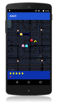
Yep, it’s PAC-Maps, and with this latest update you can find where NOT to go! Google has added imagery of “dangerous virtual beings, starting with Pinky, Blinky, Inky and Clyde. When navigating fruit-filled streets, determine at a glance which turns to pass to evade ghosts and get where you’re going safely. When you’re feeling a bit peckish, you can simply gobble up a few pac-dots or a cherry and keep on nommin’.”
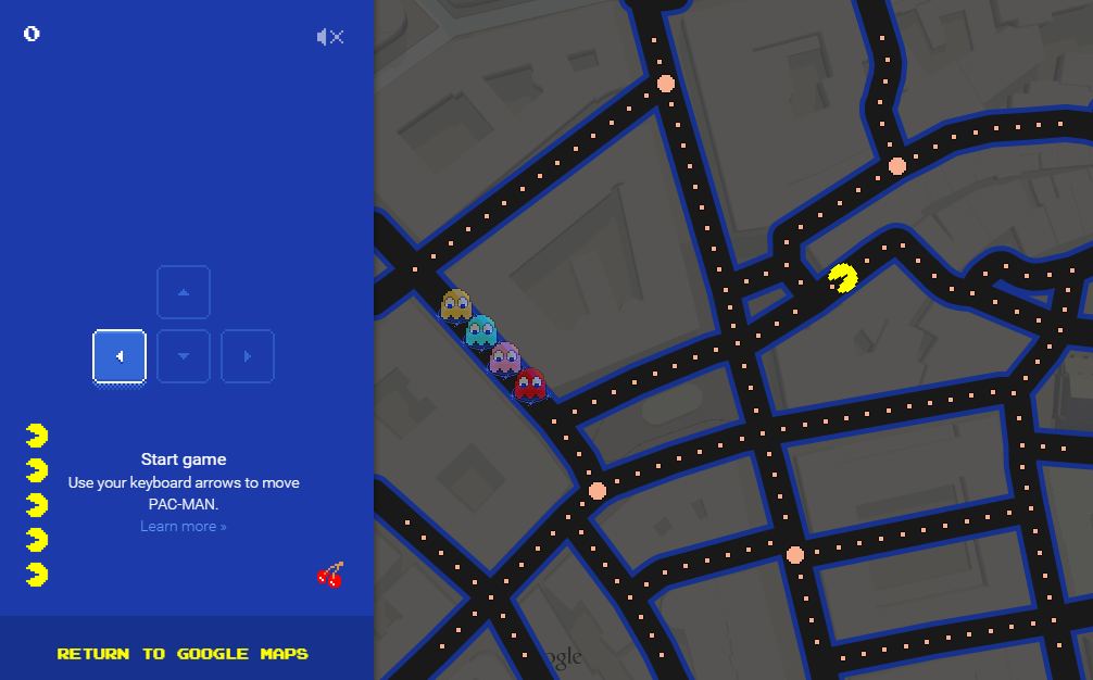
I’m a little embarrassed to say how many hours I spent playing PAC-MAN in high school. Back then we had to hunch over a machine located next to the bathrooms at the local pizza parlor. Now you can take a break from your brick walls and walka walka walka around the world from the comfort of your desk. With PAC-Maps you can navigate select locations using the left, right, up or down arrows on your keyboard. Below is a screen shot from the desktop version:
Actually, PAC-MAN isn’t new to Googlers. Back on May 21, 2010 (yep, it’s official, I’m a Google geek) Google’s home page featured a desktop version that you can still play here.
When you’re ready to head back to your genealogy brick wall, take my new book with you. The Genealogist’s Google Toolbox Second Edition makes Googling for your family tree easier than every!


