by | Oct 26, 2014 | 01 What's New, Google, Google Earth, Maps
 Genealogy Gems reader and listener Walt has enjoyed creating some exciting family history and genealogy maps and files in Google Earth using the strategies I teach here at Genealogy Gems. He wrote me recently to say that he is thrilled to have a new computer, but he is now faced with how to transfer Google Earth files he created for family history from his old computer to his shiny new one. The good news is that it’s not difficult at all!
How to transfer your Google Earth files:
1. On your old computer open Google Earth
2. All of your files in Google Earth are in the Places panel. In the Places panel, click the small arrow pointing at “My Places” to close it
3. Right-click on MyPlaces and select “Save Place As” from the little pop up menu
4. Name the file OLD GOOGLE EARTH and select where you want to save it on your hard drive. (Saving it to your Desktop will make it easy to find, or just your C: drive. If you use Dropbox, you could save it there and then easily access it from Dropbox on your new computer.)
click “Save”
5. Send an email to yourself and attached the save .KMZ file that you just created.
6. Open the email on your new computer
(make sure you already have Google Earth downloaded on to your new computer)
7. Double click the attached KMZ file to open it
8. Your computer will detect it is a Google Earth file and will open it in Google Earth.
9. The file will be stored in the Places panel under Temporary Places
Click, drag and drop the file from Temporary to MyPlaces
Under the menu click FILE > SAVE > SAVE MY PLACES to save it.
 Want to learn more about using maps in Google earth for your family history research? Watch my FREE class on Google Earth for Genealogy. And we have a 2 disk video tutorial bundle in our store that will walk you through exciting projects step by step.
Genealogy Gems Premium members can also watch my NEW video class online, 5 Ways to Enhance Your Genealogy Research with Old Maps. (Not a Premium member? Learn more here.)
by | Sep 5, 2014 | 01 What's New, British, Google, Google Earth, Maps
 Have you ever found yourself looking for an ancestor’s address that doesn’t seem to exist anymore? Here are some strategies I recently shared via the following Q&A:
Question: From the 1881 Census in England I uncovered the address for my relative: 3 Buckingham Mews, Kensington Place, London, England. When I enter this in the search it gives me 3 Buckingham Mews, Westminster, London,UK.
I don’t know anything about London so I don’t know if this is the same thing but just with current location names. Any suggestions?
My Answer: As with many genealogical questions, this is a question that will likely require several sources in order to answer. I’ve been to London many times and my perception is that Kensington and Westminster are separate areas. Boundaries have certainly changed over the years in London, and England at large though. Here is the direction I would suggest:
1) Google Earth – a search of 3 Buckingham Mews, Kensington actually delivers 3 possible locations (2 in “London” and 1 in “Westminster”). You can save each one to My Places (I would recommend creating a folder especially for this question). At the bottom of the results list you will see an icon that looks like a folder with a down arrow. Click it to download the locations to MyPlaces. Also, be sure to run a search simply on “3 Buckingham Mews” and let Google Earth show you all the possibilities.
2) Go back to your original source: the census. Since there is confusion about the address of your ancestor, look for other addresses listed nearby and plot those in Google Earth. My hunch is that you will begin to build a profile of the census area, and see the relationship between that neighborhood and the 3 results Google Earth delivered.
3) Check Rumsey Historical Maps in Google Earth – LAYERS > GALLERY > RUMSEY (click the Rumsey box). You may need to zoom out a bit to locate the available historical maps. You’ll find that there is one from 1842.
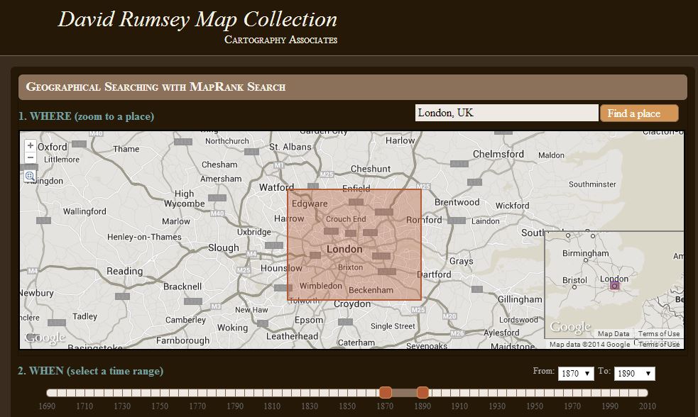
4) Search for applicable maps at the David Rumsey Historical Map Collection. On the home page scroll down and click “Launch Map Rank Search.” From that page you can select London, and then narrow in on the time frame. I would go for a spread of 1870-1890 (see below: you’ll move both pink boxes to set the time parameters on the timeline). There are several excellent maps available to download from that query. Sign up for a free account on the website and you will be able to download the highest resolution maps. You can also, of course, work with the map right on the website.
5) Google Search – Run some searches on the history of London boundaries and boroughs. Here’s a link to a page a found in Wikipedia on “London boroughs.”
By exploring multiple sources you should be able to create a “data visualization” that zeros in on the correct location. I hope you’ll share what you find with me!
Want to learn more about using Google Earth for genealogy? I offer a 2-CD bundle that demonstrates how to:
- download and use Google Earth;
- identify where old pictures were taken;
- explore church record origins;
- plot ancestors’ homesteads and pinpoint their properties;
- create custom historic map overlays;
- save and share images and videos;
- customize placemarks;
- create 3D models of ancestral locations; and
- create unique family history tours. Click here to learn more!
by Lisa Cooke | Jun 12, 2014 | 01 What's New, Google, Maps, Military
 World War II started a revolution in map-making. It didn’t just change maps, but it also changed how the world looked at maps.
Maps suddenly became very interesting to everyone. Not just war strategists and troops but all those left behind on the home front. This interest was fueled even more by a revolution in how maps were made–a revolution that anticipated the information-sharing power of Google Earth.
“War has perennially driven interest in geography, but World War II was different,” reports this article in New Republic. “The urgency of the war, coupled with the advent of aviation, fueled the demand not just for more but different maps, particularly ones that could explain why President Roosevelt was stationing troops in Iceland, or sending fleets to the Indian Ocean.”
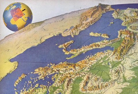
The story focuses on artist Richard Edes Harrison, whose World War II maps portrayed theaters of war with vivid clarity. He used the artist’s tools of shading, color and perspective to create maps “that could be intuitively understood by readers of widely varied levels of literacy and sophistication.” His “colorful and sometimes disorienting pictures (not quite maps)…emphasized relationships between cities, nations, and continents at the heart of the war. These maps were published in Fortune, then issued in an atlas that became an instant bestseller in 1944.”
After reading the article I ran a quick check of Google Books, one of my favorite go-to genealogy resources online, on “Richard Edes Harrison:. Sure enough, Google Books has a fully digitized copy of Life magazine (Feb 28, 1944) which includes the article “Perspective Maps: Harrison Atlas Gives Fresh New Look to Old World.” It’s not only chock full of his color maps, but includes a detailed section on how he drew his maps. You can see it here
What really caught my attention was the article’s explanation of how these World War II maps anticipated the information-sharing power of Google Earth. Google Earth shows us the terrain as well as geographic boundaries. That helps us understand things like movements of troops–or movements of ancestors.
As genealogists, we can learn so much by studying maps–particularly the powerful ones on Google Earth. Genealogy Gems Premium Members have access to my series of videos on Geographic Genealogy, including: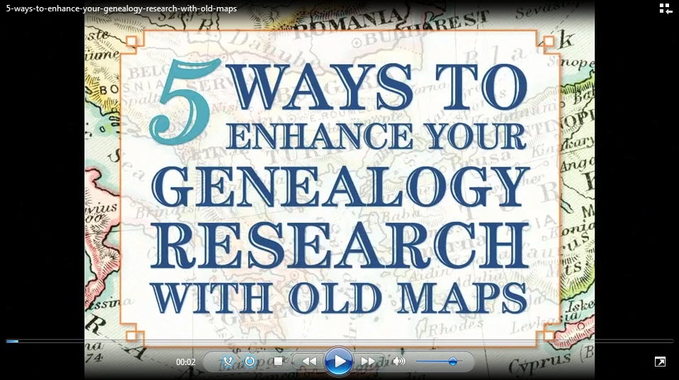
- Google Earth for Genealogy
- Time Travel with Google Earth
- 5 Ways to Enhance Your Research with Old Maps (brand new full hour class – retail value alone $39.95)
P remium Membership is a bargain at only $29.95 for an entire
  year’s access, plus right now you get the free bonus ebook Lisa Louise Cooke’s 84 Best Tips, Tricks & Tools from Family Tree Magazine.
Click here to learn more about Premium Membership.
by Lisa Cooke | Apr 24, 2014 | 01 What's New, Google, Maps
Google Maps Street View was given an edge today over Google Earth’s street view when Google launched a “time travel” upgrade. The ability to time travel is high on most family historians list, and Street View imagery for Google Maps desktop provides a taste of that prize.
According to Google’s blog post today they have “gathered historical imagery from past Street View collections dating back to 2007 to create this digital time capsule of the world.”
Here’s an example of viewing Gettysburg with the new feature. In many cases, there’s nothing earth shattering to see. But in some locations which have undergone substantial change in that short time period (such as viewing the reconstruction after the devastating 2011 earthquake and tsunami in Onagawa, Japan) the results are riveting.
Don’t worry if you don’t see Google Maps Street View Historical Imagery feature yet. When you have millions of users it can take a while to roll out upgrades.
Members Have Been Time Traveling for a While Now
If you’re a Genealogy Gems Premium Member then chances are you made a bee-line for the Time Travel with Google Earth premium video as soon as you joined. In that video we explore some incredibly powerful ways to travel back through our ancestor’s lives and times. And while I still think that those techniques deliver more relevant results for genealogists, this new Street View time travel in Google Maps is exciting in its own way. It offers a glimpse into the future.
Consider this: Google has been amassing incredible amounts of data over its short life including satellite and street view imagery. 7 years in and they can now begin to offer this collection of older imagery in a meaningful way. Imagine what historical street view imagery will look like in 10, 25, or 50 years from now!
After Looking Back in Time, I Offer This Prediction for the Future
While this feature has just rolled out in Google Maps, and is not yet available in our beloved Google Earth, I predict this omission will not last long. You may have already noticed that as you zoom in closer to street level in Google Earth a small clock icon appears at the bottom of the screen indicating historical satellite imagery is available. Next to the icon a date now appears indicating the earliest available imagery. Click the Historical Imagery icon in Google Earth’s toolbar and a time slider indicating the years available will appear.
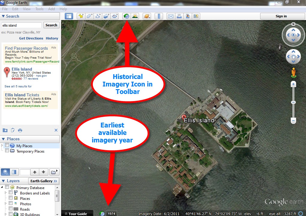
For most areas of the world this spans about as long as satellite imagery has been around. But in some key areas, such as London and parts of Europe, the slider goes back to the World War II era. Black and white aerial imagery of war torn areas are plainly visible. (If you have World War II veterans in your family tree, this is a feature you’ll want to explore.) It can only be a matter of time before this same Historical Imagery comes to Google Earth’s Street View.
 More Ways to Explore and Time Travel Now
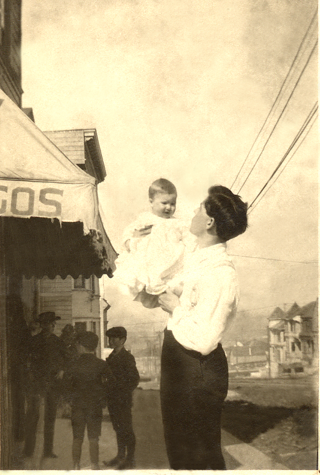
If you are intrigued by the idea of using this technology to simulate your own genealogical time travel experience, watch my free video called Google Earth for Genealogy. You’ll travel along with me as I uncover the secrets of a photograph taken just over one hundred years ago, pinpoint the location today, and then travel back in time to further explore my ancestor’s neighborhood. From there, the sky is the limit with Google Earth and Google Maps!
Further Reading:
by | Feb 3, 2014 | 01 What's New, Google, Photographs
 Do you have old pictures but aren’t sure where they were taken? Sometimes Google Earth has the answer. Check out this question from podcast listener Dennis:
Q: “I am scanning slides from my only trip to my ancestor’s home in rural Germany and don’t recall the names or locations of a few people. The clue hear is ‘slides’. They were taken in 1986! I have a question regarding something I thought I heard on one of your podcasts regarding identifying a building via a picture that is uploaded to a web site. Can you give me some help with this?”
A: Yes! On my website, I offer a FREE video in which I demonstrate how to identify a building in an old photo using Google Earth. You can watch the free video by going to www.GenealogyGems.com, hover your mouse over VIDEO, and click on Google Earth for Genealogy in the drop down menu.
Another option is to use the free Google app on your smart phone or tablet. Open the app, tap in the search box, tap the Camera icon, and take a photo of the photo you have that contains the building you want to identify. (This works best with more well known locations.) It’s a long shot, but you never know – Google just may be able to identify it.
 Good luck, Dennis–and all the rest of you out there who are puzzling over how to identify old photos’ locations.
Find more tips on using Google Earth for Genealogy in my popular Google Earth for Genealogy 2-Disk Bundle. The free video is just the beginning of what you can do with Google Earth!
 Want to learn more about using maps in Google earth for your family history research? Watch my FREE class on Google Earth for Genealogy. And we have a 2 disk video tutorial bundle in our store that will walk you through exciting projects step by step.


